
The US Department of Agriculture and NASA signed a Memorandum of Understanding in Washington on 24 October 2026 to work together on bringing Earth observation, geospatial analytics and statistical methods into the department's agricultural statistics. Agriculture Secretary Brooke L. Rollins and NASA Administrator Jared Isaacman signed the agreement, which USDA said takes effect immediately.
The problem the two agencies name is the quality of the numbers farmers and markets rely on. USDA said the cooperation is meant to strengthen its data quality and to make sure American farmers and ranchers have access to new technologies. Secretary Rollins said the partnership would "enhance USDA acreage and yield estimation", the crop figures that move planting, marketing and insurance decisions.
Under the memorandum the cooperation may cover agricultural statistics, remote sensing science, modelling, geospatial data engineering and what the release calls super intelligence and machine learning. The list is not meant to be complete: the department said further areas may be added as priorities change, and the two sides will look for other openings to collaborate.
NASA would bring its sensing, computing and analytical capabilities. "By combining NASA's Earth observation data and technical expertise with USDA's knowledge of American agriculture, we can improve the information available to farmers and ranchers," Administrator Isaacman said, adding that it would also improve understanding of crop conditions and natural hazards.
The two agencies have a long-standing relationship. USDA said new work on crop performance for goals on Earth and in space began in December 2025, after President Trump issued Executive Order 14369, "Ensuring American Space Superiority", when NASA and USDA started exploring ways to improve agriculture, observe the environment and contribute to human health.
The agreement supports the USDA Data Modernization Plan that Secretary Rollins launched in September, which the department says is meant to reduce unnecessary reporting burdens on producers and make agricultural data more timely, accurate and useful. The release did not give a budget, a timetable or the first datasets to be shared.
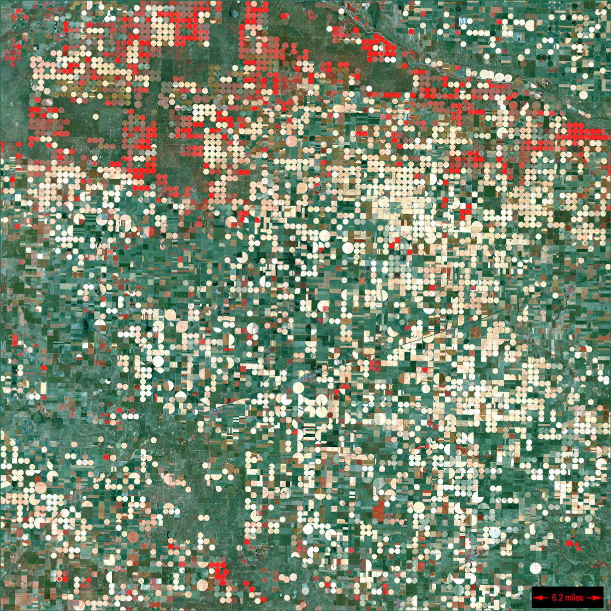
Photo: NASA/USGS Landsat 7 (irrigated fields near Garden City, Kansas) / Wikimedia Commons (public domain)
Source: USDA
Comments
(0)