
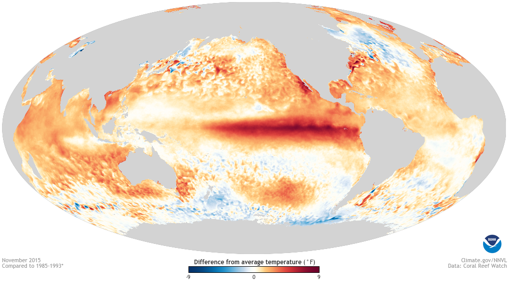
El Nino, the warming of surface water in the central and eastern Pacific above normal, has strengthened over the past few months. The World Meteorological Organization says it will grow stronger still and last at least until 2027, and the US National Oceanic and Atmospheric Administration (NOAA) expects conditions to intensify through the rest of 2026.
Many forecasts say it could be one of the strongest El Ninos on record. Added to decades of human-caused warming, it could make 2027 the warmest year on record, with major disruption to weather, food supplies and economies.
The first effect is in Indonesia, which is going through its worst fire season since 2015. At least 895,657 hectares have burned since January, more than twice last year's area. About 175,000 people in Sumatra and Kalimantan have suffered respiratory illness from the haze, more than 40,000 of them children.
Second, the eastern Pacific has had 22 named storms and 12 hurricanes so far, 10 of them major, already more than an average full season with two months still to go. Third, the Atlantic shows the opposite: stronger wind shear has held it to a single hurricane, Isaias, the latest first hurricane of the satellite era.
The fourth effect matters most for farming. India's monsoon rainfall is 13 percent below average. The shortfall is about 26 percent in the east and northeast and 24 percent in the southern states, and even where totals were near normal, long dry spells were followed by bursts of heavy rain, raising the risk to farm output. Scientists say El Nino may not have been the only cause.
Fifth, in the western Pacific the Japan Meteorological Agency has counted 10 tropical cyclones, the most in any season since 1966. During El Nino storms tend to form farther east of Japan and eastern China and spend longer over warm water, so they can grow into stronger typhoons.
Photo: Sea surface temperature anomalies during the El Nino of November 2015, NOAA / Wikimedia Commons (public domain)
Source: Banglanews24


Comments
(0)