
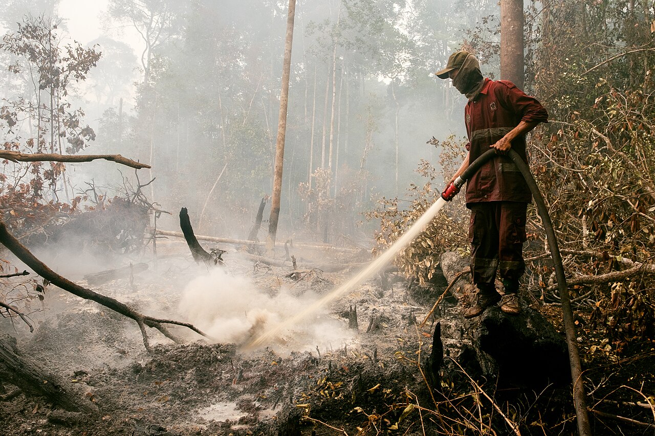
Indonesia's forest fires this year are the most intense in 11 years, burning across six provinces of Sumatra and Kalimantan and sending haze to Malaysia, Singapore and the Philippines, Dialogue Earth reported. The monitoring platform Nusantara Atlas counted 1.9 million hectares burned from January to September, much of it in one of the driest Septembers in more than three decades, and about a million more hectares by November.
Peat is at the heart of it. Protected peatlands made up half of the area burned from January to September. Indonesia holds almost 36% of the world's peatlands, more than 24 million hectares of waterlogged organic soil that stores vast amounts of carbon. Wet, peat resists fire; drained or degraded, it burns underground, spreads unseen, is hard to put out and releases carbon and thick haze. Peatlands are typically cleared for palm oil, timber and other export crops, and the World Resources Institute (WRI) says almost all fires in Indonesia are caused by people.
Farming policy lit some of the worst. In 1997 the Mega Rice Project tried to turn one million hectares of peat in Central Kalimantan into rice paddies; canals drained the land and farmers cleared it by burning. In a strong El Niño year, the fires spread out of control and burned nearly 10 million hectares in Sumatra and Kalimantan, a regional haze that cost about USD 10 billion through transport, crops, timber, tourism and health, according to WRI. The old project area still burns regularly. Burning to clear land has been illegal since 2009.
Climate is making it worse. Scientists found this month that fossil-fuel warming raised temperatures by 1.6C during the August-October peak fire season, while El Niño added 0.3C and cut rainfall by about half. The Centre for Research on Energy and Clean Air estimates that air-pollution deaths rose 42% between August and September, from about 3,740 to 5,310; schools closed in parts of Metro Manila and Malaysia.
Remedies exist on paper: the 2002 ASEAN haze agreement, which Indonesia ratified in 2014; a permanent moratorium on new licences in primary forest and peatland since 2019; a new National Peatland and Mangrove Management Agency set up in September 2026; court rulings against concession holders; and a disaster agency map linking satellite fire data to land permits. Margareth Sembiring of Singapore's Nanyang Technological University says breaking the cycle needs sustained funding for frontline fire prevention and collective action that respects Indonesia's sovereignty.
Reporting by Fidelis Eka Satriastanti for Dialogue Earth.
Photo: DenY Krisbiyantoro / Wikimedia Commons (CC BY-SA 4.0)
Source: Dialogue Earth

Comments
(0)