
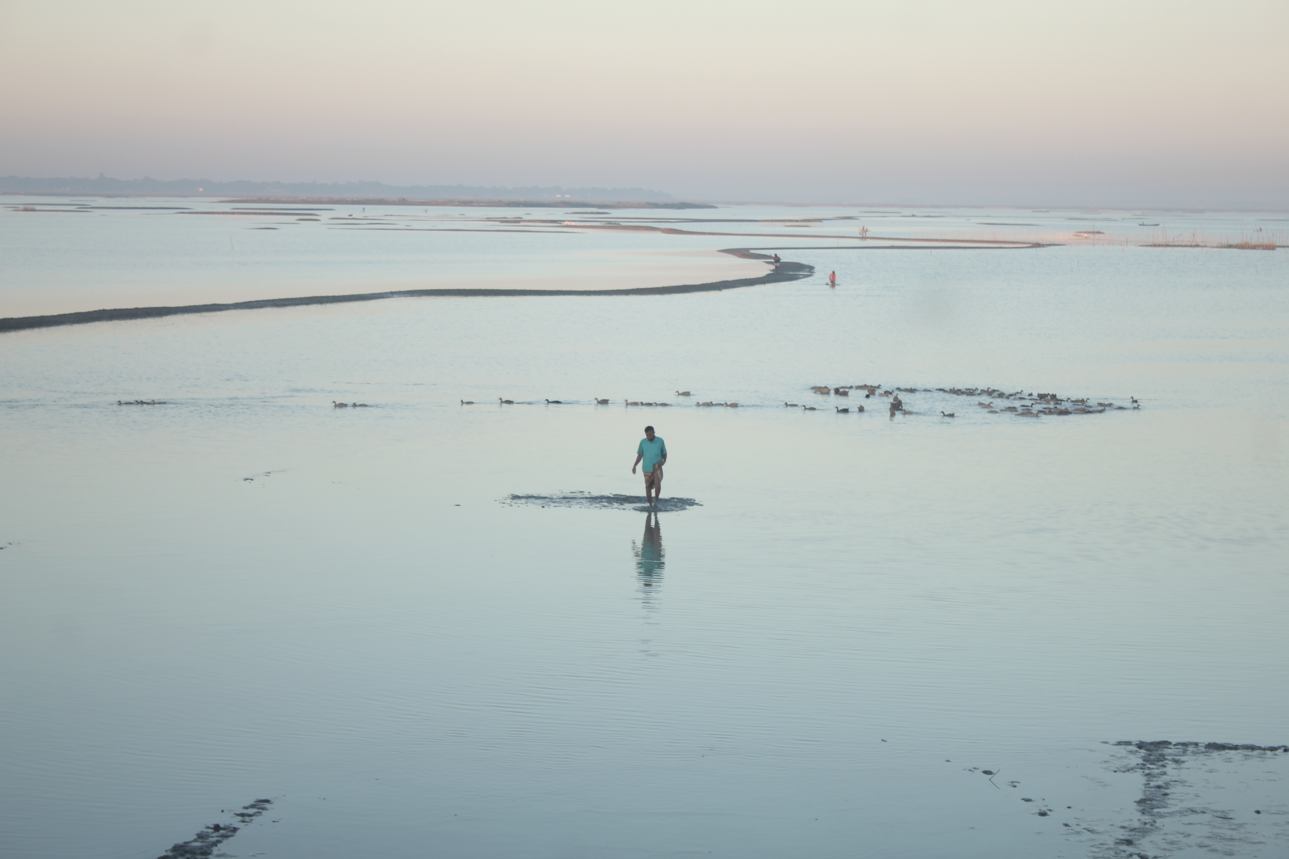
With several days of continuous rain easing, the rivers of Kishoreganj district had started to fall on Thursday 7 May 2026, and every river in the district was flowing below its danger level, Jagonews24's Kishoreganj correspondent reported that morning. The sun had been out since the morning, but sudden showers from time to time were still causing trouble for farmers in the haor, the low wetland basin in the east of the district where most of its boro paddy grows.
According to the office of the executive engineer of the Kishoreganj Water Development Board at 9am that day, the Dhanu-Baulai river at the Itna point had fallen to 3.27 metres, 1 centimetre lower than 24 hours earlier. At Chamraghat the water stood at 2.93 metres, down 2 centimetres; the Kalni at Austagram had fallen 8 centimetres to 2.57 metres; and the Meghna at Bhairab Bazar was at 1.62 metres, down 2 centimetres. The Water Development Board said the district's rivers were still well below danger level, flowing 88 to 418 centimetres below it at the different points.
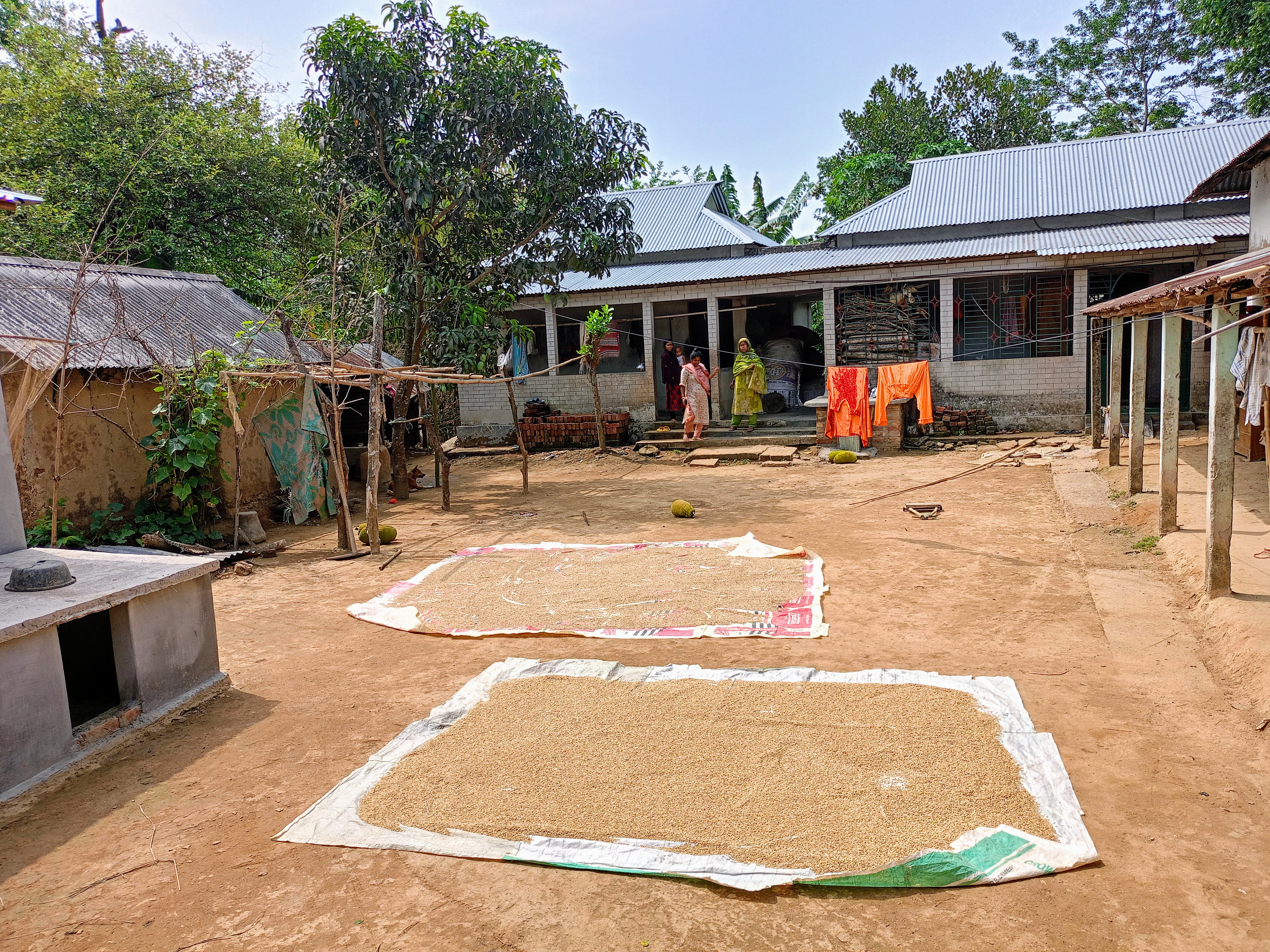
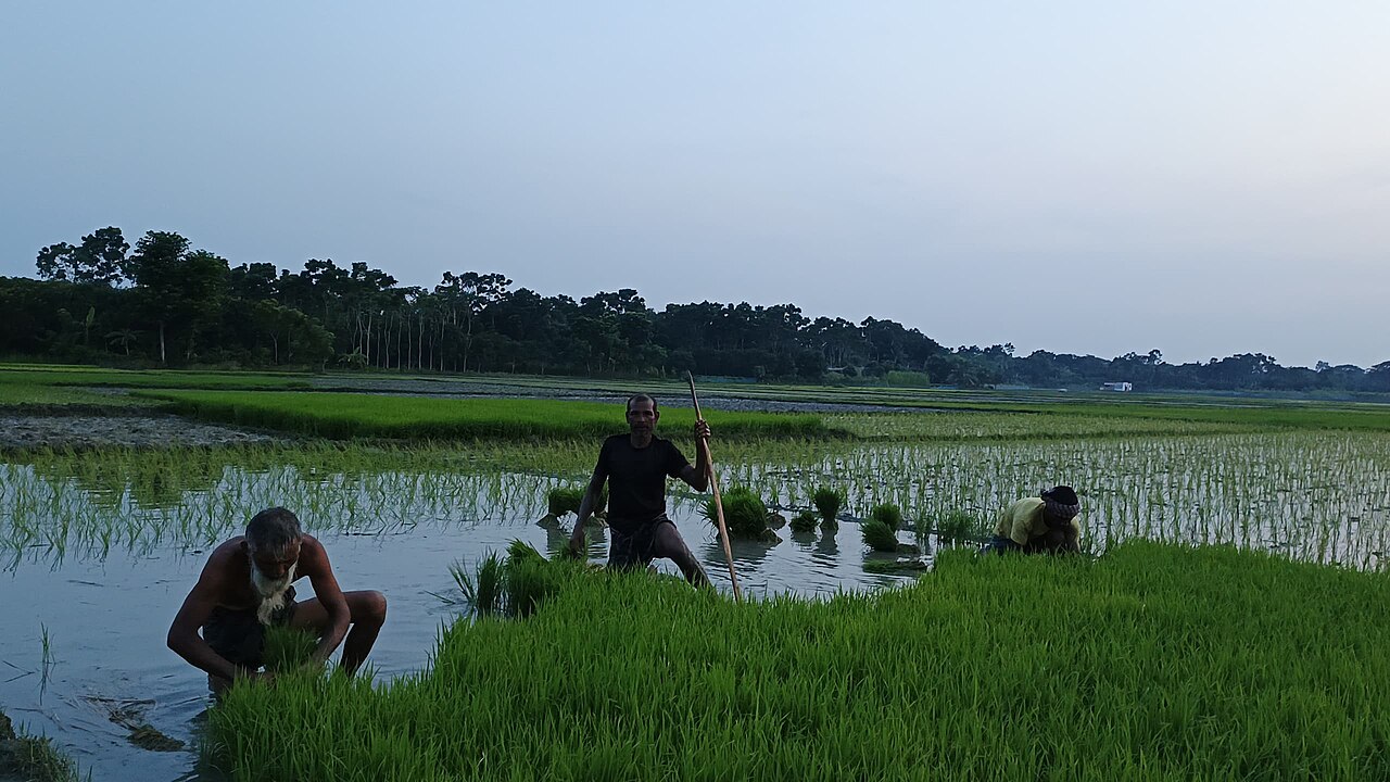
After several days of rain, the clear sky and sunshine had brought life back to the haor. Farmers were busy recovering paddy from submerged fields and drying the paddy kept on their khola, the threshing and drying yards beside the fields. Those involved in the work feared, however, that if water from upstream and heavy rain returned, the rivers could rise again and bring fresh harm to farming and daily life in the haor.
Md Sajjad Hossain, executive engineer of the Kishoreganj Water Development Board, told Jagonews24 that the situation was being monitored round the clock, and that the local administration and farmers had been asked to stay alert to deal with possible risks.
Dr Sadiqur Rahman, deputy director of the Department of Agricultural Extension (DAE) in Kishoreganj, said that according to information received up to 4 May, paddy on 11,122 hectares in the district's 13 upazilas was under water. About 50,000 farmers had been affected, and the loss was estimated at about Tk 259 crore. Since then about 1,500 more hectares of boro paddy had been newly submerged, he said, and work on listing the affected farmers was under way.
River levels at the four gauges
The four readings Jagonews24 reported come from the gauges the Water Development Board watches in Kishoreganj: Itna in the haor's north-east, Chamraghat in Karimganj upazila, Austagram in the south-east and Bhairab Bazar at the district's southern tip, where the Meghna leaves it. Jagonews24 named the river at Chamraghat as the Meghna. In its report of 2 May on the same gauges, Dhaka Tribune named the river monitored in Karimganj's Chamrabandar area as the Magra, and listed the others as the Dhanu-Baulai in Itna, the Kalni in Austagram and the Meghna in Bhairab.
Five days before the fall, the picture had been different. On 2 May, Sajjad Hossain told Dhaka Tribune that the water in these rivers had risen by several centimetres in recent days, though it was still below danger level. He said that in some areas farmers were cutting embankments on their own to drain the excess rainwater from their fields. On both dates the Kishoreganj rivers were below danger level; the reports put the damage down to persistent rain and a surge of water from upstream, with rainwater left standing in the fields.
The danger levels quoted are the Water Development Board's reference marks for each gauge. For the haor rivers in April and May, the board's Flood Forecasting and Warning Centre (FFWC) reports levels against a separate pre-monsoon danger level. On 29 April, the FFWC bulletin said the Dhanu and Baulai rivers in Netrakona and Kishoreganj might rise over the following three days, along with the Surma and Kushiyara in Sylhet and Sunamganj and the Manu, Khowai and Juri in Moulvibazar and Habiganj, New Age reported.

How the damage figures grew
The DAE figures had grown through the week. On 1 May, Dhaka Tribune and New Age reported that around 7,000 hectares of cropland had been submerged in Kishoreganj after several days of continuous rain, with 160 millimetres of rainfall recorded in the district over the period. Dr Md Sadikur Rahman, the DAE deputy director, said then that some parts of the haor had been inundated. "We are inspecting the affected areas and preparing a list of the damaged land and farmers. The list will be sent to higher authorities, and we hope all affected farmers will be brought under government incentive programmes," he told the papers.
On 2 May, Dhaka Tribune gave the DAE's narrower count for the four haor upazilas: 6,768 hectares of boro in Itna, Mithamain, Austagram and Nikli had been inundated by rising river water and flash floods, affecting about 21,000 farmers during the peak of the harvest. By the official's figures given to Jagonews24 on 7 May, the count for all 13 upazilas up to 4 May had reached 11,122 hectares and about 50,000 farmers, with about 1,500 hectares more submerged after that date.
Those numbers sit against a large crop. The DAE said 168,262 hectares of land in Kishoreganj had been brought under boro paddy in the 2026 season, across all 13 upazilas. Of that, 104,535 hectares lay in haor areas, which are exposed to flash floods in the pre-monsoon period, Dhaka Tribune reported. Kishoreganj is one of Bangladesh's major boro-producing districts.
A harvest caught between rain and sun
The rain came at the worst moment of the farming year. Late April and early May is the peak boro harvest in the haor, when paddy is cut, threshed and dried in the sun before it is stored or sold. New Age reported on 1 May that continuous rain had also submerged threshing yards, causing harvested paddy to sprout instead of drying and leaving farmers with no option but to sell the damaged crop at low prices. Many had taken loans from moneylenders to grow what is their only crop of the year. "We had a good yield this year, but everything has gone under water due to continuous rain. Now we are worried about how to repay our loans," several farmers told the paper.
Dhaka Tribune described the same see-saw on 2 May. After several days of continuous rain, mild sunshine had appeared on the previous Thursday and given farmers hope, but cloudy skies returned on the Friday morning and rain fell again through the night, continuing in parts of the district until Saturday morning. Paddy harvested in recent days lay piled in fields, on threshing floors and in courtyards without drying, and the grain was discolouring and rotting. A farmer from Majlishpur in Nikli upazila told the paper that floodwater had covered about 10 kanis of his land, and that rain had kept him from drying the semi-ripe paddy he had paid labourers to cut from about six kanis. "Now the paddy has turned black," he said.
Labour was short as well. Farmers told Dhaka Tribune that even wages of up to Tk 1,200 a day had failed to attract enough workers to cut the paddy still standing in waterlogged fields. The DAE deputy director urged farmers to harvest paddy that was at least 80 per cent mature to limit further losses. "This is not the ideal situation, but delayed harvesting could lead to even greater losses," he said. It is the same rule the DAE had given haor farmers before: in April 2024, when it forecast heavy rain for Sylhet, Sunamganj, Habiganj, Moulvibazar, Kishoreganj, Brahmanbaria and Netrokona, it asked them to harvest boro once it was 80 per cent ripe, to raise the borders of their fields and drain standing water, and not to apply pesticide or fertiliser before the rain.
When the sun did come out in the neighbouring Sylhet division on 5 May, farmers in the low-lying areas of Sunamganj, Moulvibazar and Habiganj began drying wet paddy from the haors in their yards, on high ground and along roadsides from early morning, New Age reported. The sunshine Jagonews24 described in Kishoreganj on 7 May brought the same work, and the sudden showers interrupted it.
Rain across the north-eastern haor
Kishoreganj was one part of a wider spell of rain over the north-eastern haor basin. On 28 April, the boro crops of Naluar Haor in Jagannathpur upazila and Eranbil Haor in Madhyanagar upazila of Sunamganj went under water after heavy rain that had fallen since the Sunday and floodwater from a river across the border, New Age reported. The Sunamganj Water Development Board recorded 137 millimetres of rain in the 24 hours to 9am that Tuesday. Many farmers of Naluar Haor alleged that their crops had been submerged because there was no way for the water to drain.
The next day, an embankment on the Gogalichhara, a hill canal, collapsed in Kulaura upazila of Moulvibazar, marooning people in about 15 villages, and the low-lying areas of Netrakona remained flooded, New Age reported on 30 April. The FFWC issued a 72-hour flood warning for the low-lying areas of Sylhet, Habiganj and Sunamganj.
By 5 May, after seven consecutive days of cloud and rain, the sun returned to the Sylhet region. The DAE said ripe and half-ripe paddy on about 34,000 hectares in the four districts of Sylhet division had been submerged that season, and Mosharraf Hossain, additional director of the DAE in Sylhet, said about 25 per cent of the division's boro had gone under water, New Age reported on 6 May. The FFWC said nine rivers were still above their pre-monsoon danger levels at 11 points in the north-east that day, none of them in Kishoreganj, and the Bangladesh Meteorological Department forecast more light to moderate rain, with moderately heavy falls at places, over the following 24 hours. That forecast is the worry the Kishoreganj officials voiced on 7 May.
What the government had announced
On 29 April, Prime Minister Tarique Rahman told Parliament that the government would assist farmers hit by the heavy rain in the three haor districts and parts of Mymensingh for the next three months, Dhaka Tribune reported. He said he had instructed the disaster management minister to identify the farmers who had lost crops so that help could be provided, and that three days earlier, on the basis of weather forecasts, he had told the local administrations in the haor districts to prepare.
On 1 May the government also brought forward its purchase of rice from haor farmers. The collection of paddy and rice from farmers in Netrokona, Kishoreganj, Sunamganj, Sylhet, Moulvibazar and Habiganj was set to begin on 3 May instead of the previously scheduled 15 May for rice, according to a press release reported by New Age. For the boro season, the government planned to buy 1.8 million tonnes of paddy and rice from the domestic market: 500,000 tonnes of paddy, 1.2 million tonnes of parboiled rice and 100,000 tonnes of atap (sun-dried) rice. The procurement prices were set at Tk 36 a kilogram for paddy, Tk 49 for parboiled rice and Tk 48 for atap rice.
Kishoreganj and its haor upazilas
Kishoreganj district, in Dhaka division, covers 2,688.59 square kilometres and has 13 upazilas. It is bounded by Netrokona and Mymensingh on the north, Narsingdi and Brahmanbaria on the south, Sunamganj and Habiganj on the east, and Gazipur and Mymensingh on the west. Its main rivers are the Old Brahmaputra, the Meghna, the Kalni, the Ghorautra and the Dhanu. The 2011 census counted 2,911,907 people in the district, and agriculture was the main source of income for 60.18 per cent of households, according to Banglapedia, the national encyclopedia.
The haor lies mostly in four eastern upazilas, the same four named in the DAE's 2 May count, and farming dominates life there even more than in the rest of the district, by the 2011 census figures Banglapedia gives:
- Itna (401.93 sq km): its main rivers are the Surma, Dhanu, Baulai and Kalni, with Haular Haor and beels such as Maora, Chapra and Sonabandha; agriculture is the main income of 77.84 per cent of households.
- Mithamain (222.91 sq km): rivers Dhanu and Kalai, with Baragop, Gazaria and other beels; agriculture 82.48 per cent.
- Austagram (355.53 sq km): rivers Meghna, Barak, Kalni and Ghorautra, with beels including Padma, Topa and Monkhola; agriculture 82.40 per cent.
- Nikli (214.39 sq km): rivers Baulai, Dhanu, Shingua and Ghorautra, with Tegulia and Bara beels; agriculture 72.06 per cent.
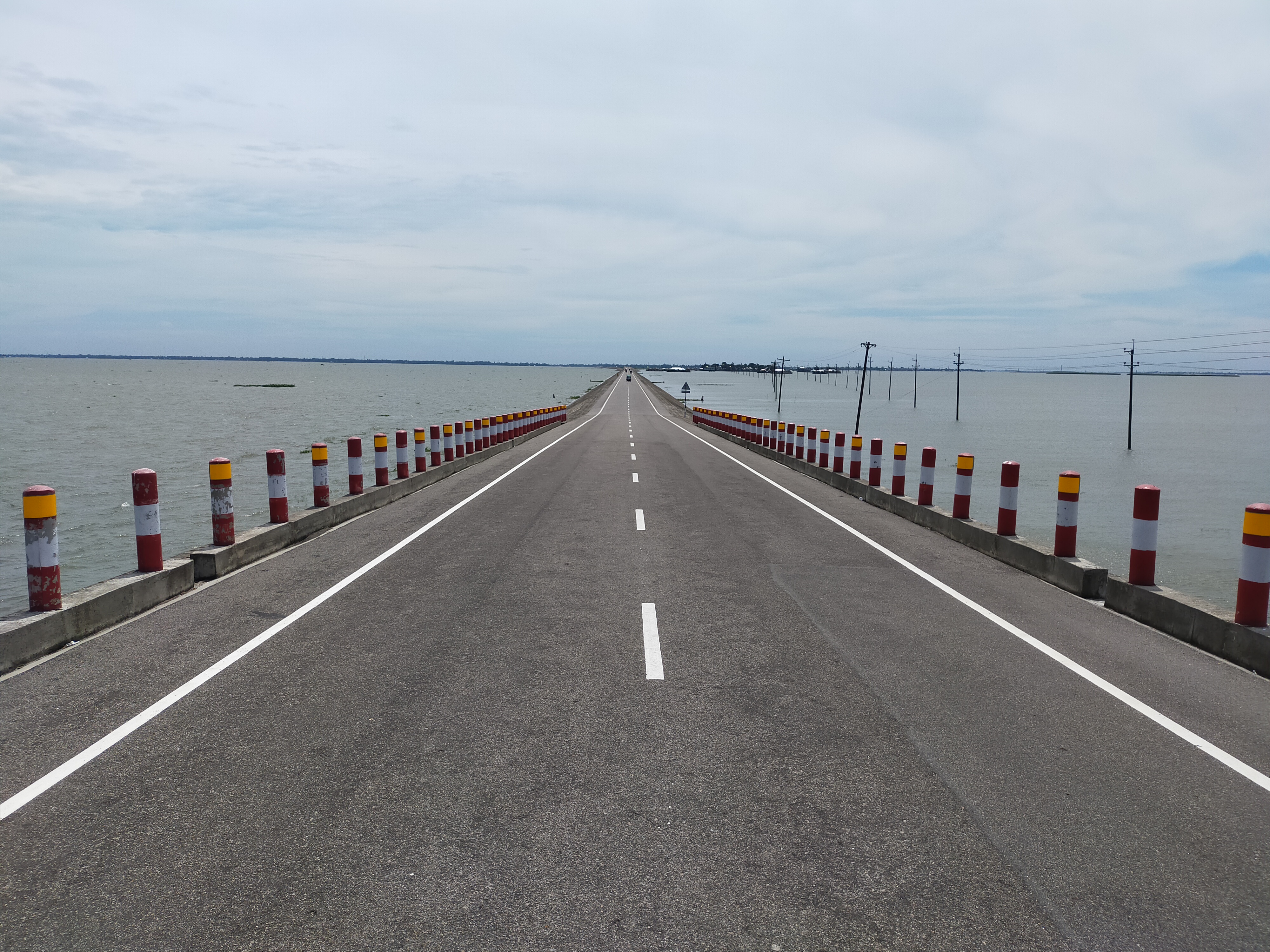
Paddy is the main crop in all four. Banglapedia lists the major haors of Kishoreganj as Humaipur, Bara Digha, Dhakir, Gopedighi, Badla, Sonabandha and Dhanpur. Itna, Mithamain and Austagram are linked by an all-weather road built across the haor.
Why boro is the haor's one crop, and why April rain threatens it
A haor is a bowl-shaped depression of tectonic origin. It fills with runoff from rivers and canals in the monsoon, becoming a vast sheet of water, and drains in the dry season. Banglapedia describes the basin of north-eastern Bangladesh as holding about 47 major haors and some 6,300 beels, of which about 3,500 are permanent and 2,800 seasonal. The plains stay flooded for about seven to eight months, when villages stand like islands; as the water drains out it exposes rich alluvial soil that is cultivated for rice.
Because the land is under water for most of the year, there is room for only one rice crop: boro, transplanted in the dry winter and harvested in April and May. Banglapedia's entry on rice gives the harvest time of local boro as April-May and of high-yielding boro as May-June. Its entry on haors and wetlands explains the risk. In April thunderstorms begin and the lowlands start to fill again, and rain on consecutive days can bring flash floods down the north-eastern rivers. Because the ground in the haor is very low, flash floods fill lowlands that have no embankments, and when the rivers run higher they overtop the submersible embankments and drown the boro across vast areas. If the crop is planted late, it is more likely to meet these floods.
Variety matters for the same reason. Banglapedia notes that short-duration boro varieties such as BR-17 (Hashi), BR-18 (Shahjalal) and BR-19 (Mongol) suit the haor because they can be harvested before the flash floods arrive, while longer-duration high-yielding varieties such as BR-14, BR-26 and BR-29, introduced for their yield, carry a greater flood risk.
To protect the crop, the Water Development Board has built low submersible embankments around the haors. Banglapedia's entry on the BWDB says the board made about 290,000 hectares in the north-eastern haor cultivable for boro and built 1,826 kilometres of such dwarf embankments to protect the crop from flash floods. Each year the work on these embankments is meant to be finished before the flood season; in 2021, for instance, Dhaka Tribune reported that the deadline for the haor embankment projects in Sylhet division had been extended from 28 February to 15 March, while local groups said much of the work remained unfinished.

The Meghna, the Dhanu and the agencies that watch them
The rivers named in the Water Development Board's readings drain the whole north-eastern basin. The Surma, coming down from Sylhet and Sunamganj, is joined by the Dhanu about five kilometres east of Kuliarchar and north of Bhairab Bazar, and below that confluence the river is called the Meghna, Banglapedia explains. At Bhairab Bazar the Meghna receives the Old Brahmaputra on its right; just above the confluence it is crossed by the Bhairab railway bridge and the Bangladesh-UK Friendship road bridge, and the river there is about three-quarters of a kilometre wide. The Bhairab gauge therefore shows how fast the water of the whole haor basin is getting away.
The Bangladesh Water Development Board was created in 1972, when the water wing of the former East Pakistan Water and Power Development Authority became a separate body; it now works under the Bangladesh Water Development Board Act 2000. Its jurisdiction covers the flow of all rivers, waterways and groundwater, and its work includes flood control embankments, drainage and irrigation, and the forecasting of floods and drought. In Kishoreganj, the readings quoted on 7 May came from the office of the board's executive engineer for the district.
Flood forecasting itself is the job of the Flood Forecasting and Warning Centre, established in 1972 under the BWDB and part of the Ministry of Water Resources. A 2023 FFWC bulletin listed 109 water-level monitoring stations and 61 forecasting stations across Bangladesh. Its daily bulletins in April and May 2026 tracked the haor rivers against their pre-monsoon danger levels.
The Department of Agricultural Extension, which gave the damage figures, works under the Ministry of Agriculture. It was formed in 1982 by merging the Agriculture Directorate (Extension and Management), the Jute Directorate, the Plant Protection Directorate, the Horticulture Board, the Tobacco Development Board and the Central Extension Resource and Development Institute, and since 1996 it has worked under the New Agriculture Extension Policy. Its Kishoreganj office, headed by the deputy director, was the one listing the affected farmers in May 2026.
A recurring threat in the haor
Rain and upstream water at harvest time are not new to the haor, and earlier reports describe the same scenes. In April 2020, Dhaka Tribune reported from Bishambharpur in Sunamganj that farmers were cutting half-ripe paddy waist-deep in water as rain and water from upstream inundated their fields, and that they could not find farmhands willing to work all day in the water. In April 2024, the DAE's pre-harvest warning for the haor districts, with its advice to harvest at 80 per cent ripeness, was issued ahead of forecast heavy rain from 3 May.
The haor's long-term planning was also under review before the 2026 rain. In August 2025, the government sought public feedback on a draft updating the Haor Master Plan, prepared by the Department of Bangladesh Haor and Wetland Development, and the National Water Resources Council's executive committee resolved to issue the first Haor Environment Protection Order under the Water Act 2013, aimed at Tanguar Haor and Hakaluki Haor, Dhaka Tribune reported. Banglapedia's account of the haors notes the trade-off behind all of this: as boro cultivation spread onto the haor rims and wetlands were drained, the haor's fish, birds and swamp forests came under pressure.
Photo: Hanif raaz / Wikimedia Commons (CC BY-SA 4.0)
Sources: Jagonews24, Dhaka Tribune, New Age, Banglapedia (National Encyclopedia of Bangladesh), Wikipedia
Comments
(0)