
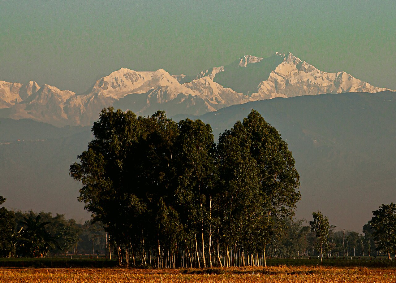
On a clear morning in late autumn, people in Tetulia, at the northern tip of Panchagarh, can sometimes see the snow-covered peaks of Kanchenjunga rising above the tree line. The mountains look close enough to belong to the fields below them. In one sense they do. The soil that farmers plough in Panchagarh, Thakurgaon and north-western Dinajpur was carried down from the Himalayas by rivers over a very long time.
Travel north from Dhaka and the country slowly changes. Busy roads and market towns give way to open fields, green crops and a landscape that does not look quite like the low, water-soaked floodplains found across much of Bangladesh. Here a farmer may face a different soil and water situation from a neighbour only a few kilometres away. One field drains within hours of a downpour; another holds water for days. One plot is more acidic than the next, and the crop notices.
Scientists have a name for this corner of the country. It is the Old Himalayan Piedmont Plain, the first of Bangladesh's 30 agro-ecological zones, known as AEZ-1.
According to the Bangladesh Agricultural Research Council's (BARC) Fertilizer Recommendation Guide 2024, the zone covers 398,154 hectares, roughly 3,982 square kilometres. It takes in most of Thakurgaon and Panchagarh and the north-western part of Dinajpur. By BARC's figures, about 190,300 hectares of the zone lie in Thakurgaon, 112,100 in Panchagarh and 95,800 in Dinajpur.
What an agro-ecological zone means
An agro-ecological zone, or AEZ, is an area where the conditions that matter most to crops are broadly alike. BARC's guide names four building blocks for the classification. The first is physiography: the shape of the land and the material it is made of. The second is soil, including its texture, how much water it holds and how fertile it is. The third is land type, which describes how deep and how long land floods in the rainy season. The fourth is agro-climatology: the length of the main growing seasons, how many winter days stay below 15°C and how many summer days climb above 40°C.
Laid over one another, these layers divide Bangladesh into 30 zones, 88 sub-regions and 535 sub-units. The zones give the broad picture; the sub-regions and sub-units are where the likeness between fields becomes much sharper. AEZ-1 sits first on the list and, quite literally, at the top of the map.
A plain built by an ancient river fan
The name tells part of the history. "Piedmont" means the foot of a mountain range, and "old" refers to the age of the land surface. BARC describes the zone as developed on an old Tista alluvial fan extending out from the foot of the Himalayas.
An alluvial fan forms where a river leaves the mountains and spills onto flatter ground. The water slows, spreads out and drops the sand, silt and gravel it has been carrying, building a broad, gently sloping apron shaped rather like an open hand fan. The Tista once did exactly that here. Layer by layer, sediment from the Himalayan region settled across the land, and the plain of today took shape. The river's main course has since moved east, but the ground it built remains.
So the region should not be pictured as one flat, featureless field. BARC describes a complex relief of broad and narrow floodplain ridges separated by long, narrow depressions. To a visitor the differences in height may look slight, yet they decide where rainwater goes. Water runs off a slightly higher field quickly, while a lower field beside it may stay damp much longer. For a farmer, that changes when to irrigate, how to drain, which crop to choose and when to sow. The landscape itself becomes part of the farming calendar.
High land in a low-lying country
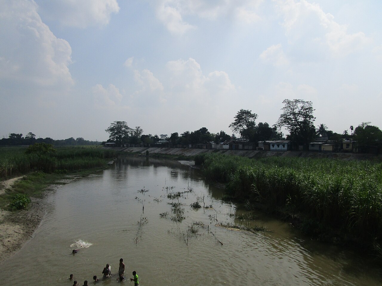
In much of Bangladesh, the monsoon means standing water for weeks or months. AEZ-1 is different. BARC's figures show that about 58 percent of the zone is highland, land that normally stays above flood level. Another 34 percent is medium highland, which floods only shallowly, and just 1 percent is medium lowland. The remaining 7 percent is homesteads and water bodies.
This mostly raised ground explains why the farming year here differs from the haor basins of Sylhet or the tidal plains of the south. Long, deep seasonal flooding is not the main worry. The questions are more often about keeping enough moisture in light soils and holding on to the nutrients that water carries away.
Even within this raised plain, conditions are not identical. Two neighbouring villages can differ in soil acidity, moisture, access to irrigation and nutrient levels. That is why a district name alone is rarely enough to decide how a particular field should be managed, and why two villages in the same upazila may need different advice.
What lies beneath the crops
To understand farming in AEZ-1, it helps to look below the plants. BARC's 2024 guide says deep, rapidly permeable sandy loams and sandy clay loams dominate the zone. In everyday terms these are light, gritty soils: rain and irrigation water soak through them quickly instead of lying on the surface.
They are also acidic. Soil acidity is measured on the pH scale, where 7 is neutral and lower numbers are more acidic. Most field crops do best in slightly acidic to neutral soil. BARC describes the topsoils of AEZ-1 as strongly to very strongly acidic, with moderately acidic subsoils, and its fertility table puts typical pH at 4.3 to 5.6 on the highland and 4.5 to 6.1 on the medium highland. Acidity matters because it changes which nutrients a plant can actually take up, even when those nutrients are present in the soil.
Seven general soil types occur in the zone, and three dominate: Non-calcareous Brown Floodplain soils, Black Terai soils and Non-calcareous Dark Grey Floodplain soils. "Non-calcareous" means the soil has no natural lime of its own, one reason it tends to stay acidic. "Terai" is the name for the belt of land along the Himalayan foothills that runs from Nepal and India into this corner of Bangladesh.
The guide lists the fertility problems plainly: low organic matter and rapid leaching of nitrogen, potassium, sulphur, calcium and magnesium. Leaching is what happens when water moving down through a light soil carries dissolved nutrients below the reach of roots. The soils also have a low cation exchange capacity, which is the soil's ability to hold nutrients and release them to plants over time. BARC notes that this leaves them with little buffering capacity, so their pH can fall quickly. Zinc and boron are rated very low to low on both the highland and the medium highland.
One caution runs through BARC's own guidance. The whole zone should not be treated as a single soil. Farmers have divided the land into small plots with different histories of use and care, and the guide notes that fertility can vary significantly even between adjacent plots. For that reason it advises collecting soil samples for detailed analysis whenever fertility data are needed for a specific place. A regional average is a starting point; a soil test tells a farmer what is in their own field.
What the land grows
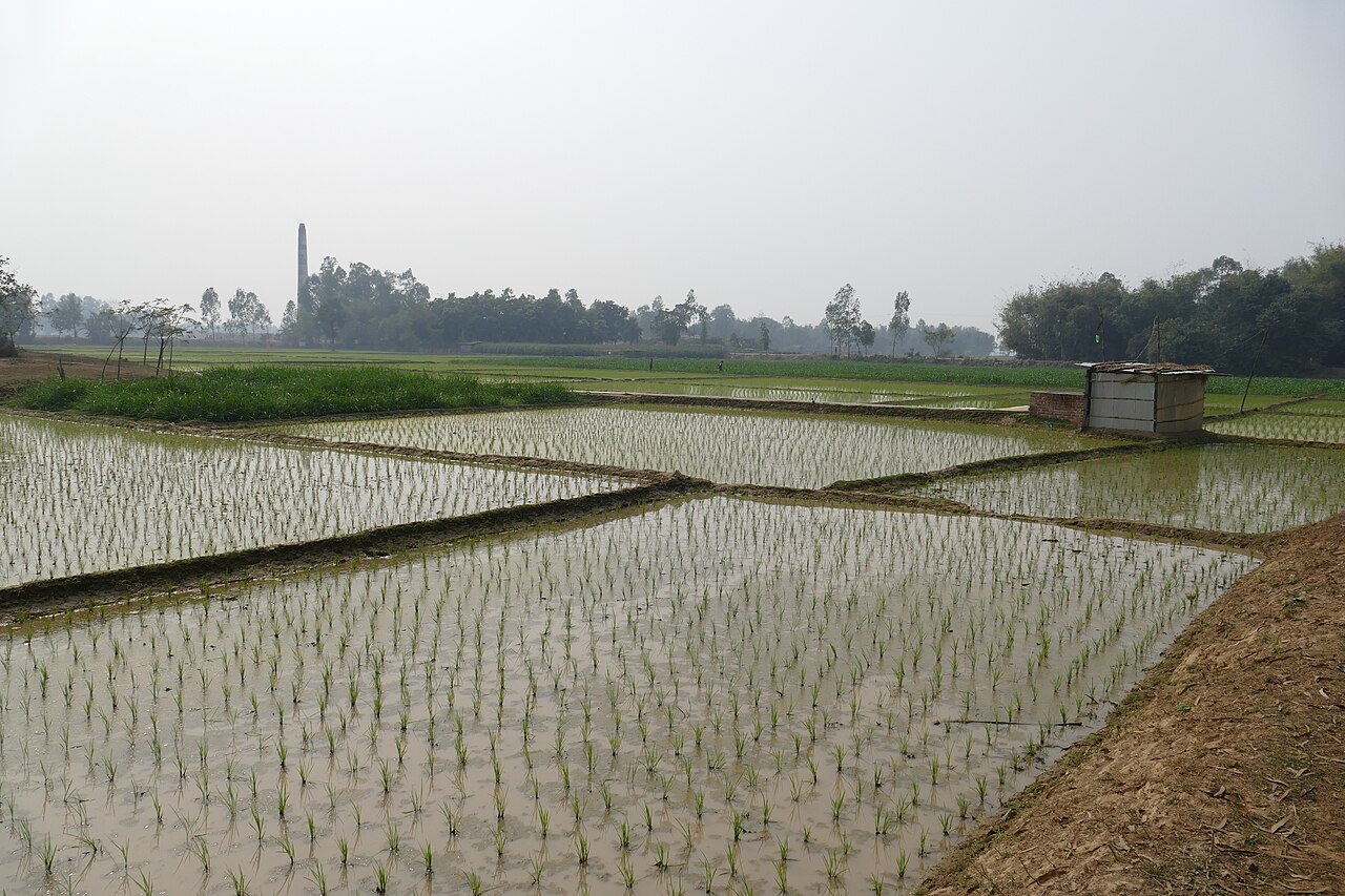
Rice sits at the centre of farming here, as it does across Bangladesh, with transplanted aman grown in the monsoon. Wheat is a major winter crop, and the light, well-drained land also carries potatoes, maize, mustard, pulses and vegetables. Thakurgaon's potatoes are known well beyond the district, along with the price risks that come with a good harvest in a crowded market.
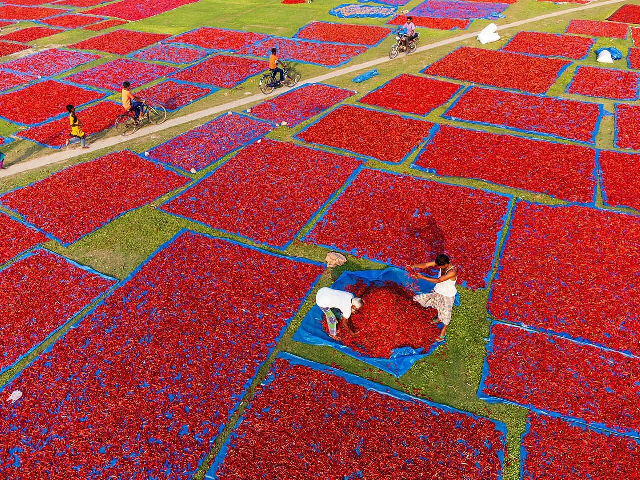
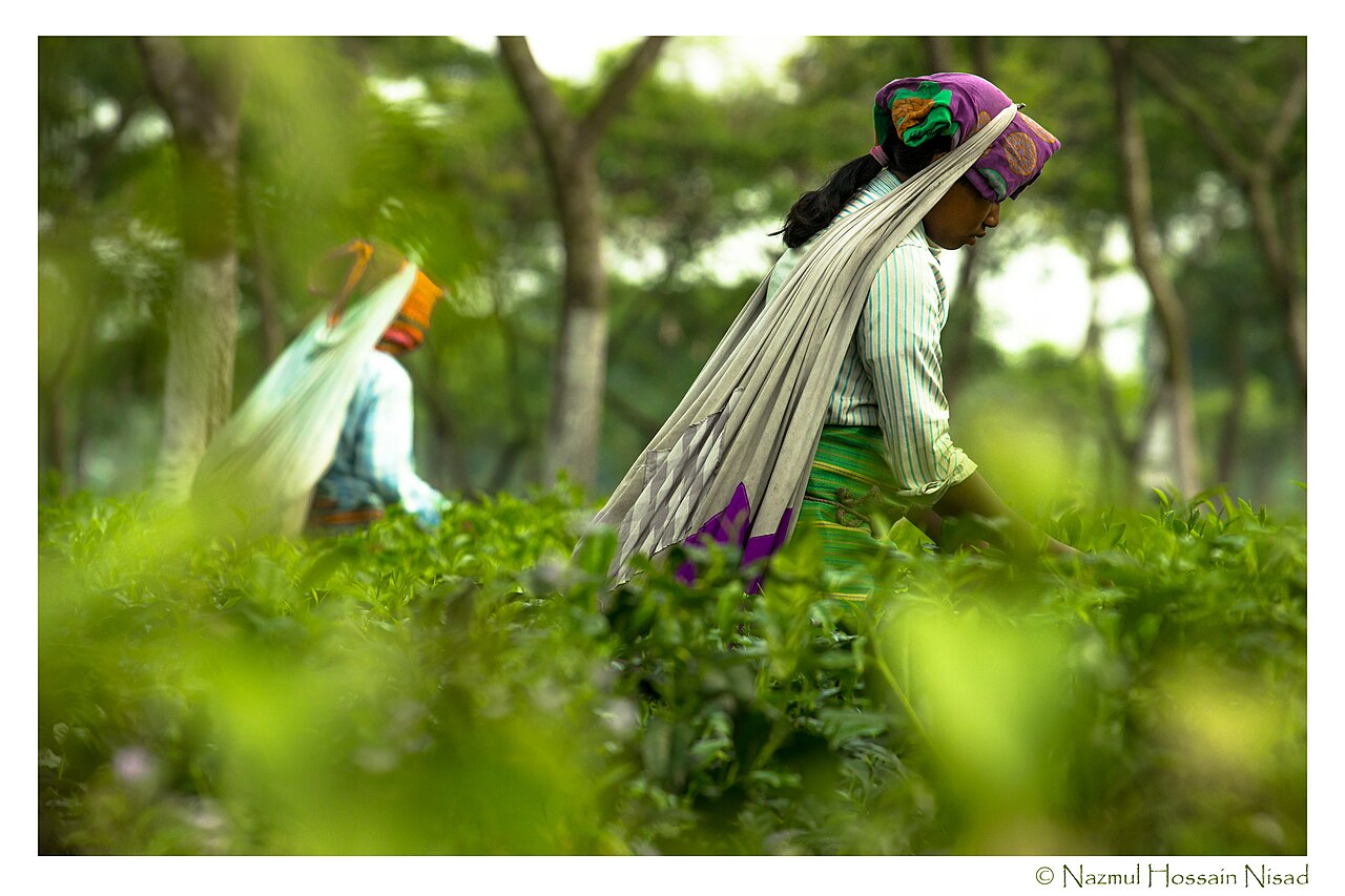
Two crops mark the northern edge of the zone in particular. In the dry months, open fields in Panchagarh turn red with chillies spread out to dry in the sun. And Panchagarh has become known for tea grown on flat land, a departure from the hill gardens of Sylhet and Chattogram where Bangladeshi tea has traditionally been grown.
Being the northernmost part of the country, the zone also has noticeably cooler winters than the south, and Tetulia is often named in winter weather reports as the coldest place in Bangladesh. That matters to farming, which is why the number of cool days is one of the measures the AEZ system uses to describe each zone's climate. The long, cool winter suits crops such as wheat and potatoes.
When research reaches the farmer's field
Acidity in the Old Himalayan Piedmont Plain is not a new discovery, and it has already been tested in the field. A study published in 2019 in the Asian Journal of Soil Science and Plant Nutrition examined lime and manure on a wheat, mungbean and transplanted aman rice rotation. The trials ran for two consecutive years at an Agricultural Research Station of the Bangladesh Agricultural Research Institute (BARI) and on farmers' own fields.
Lime works like an antacid for soil, raising its pH. Manure adds organic matter, the decomposed plant and animal material that helps soil hold water and nutrients. The researchers tested three lime rates (none, one and two tonnes of dolomite per hectare) against poultry manure, farmyard manure and no manure.
Liming raised soil pH, and manure improved organic matter. One tonne of lime combined with three tonnes of poultry manure per hectare gave, on average, 35 to 55 percent more wheat than untreated plots, and 41 to 43 percent more aman rice later in the rotation. Poultry manure did better than farmyard manure.
The larger lesson is not about a single bag of lime. The researchers took a real problem of this soil, tested answers under real farming conditions and measured what changed. That link between research and farming is what turns a scientific finding into a practical solution.
Beyond the harvest: the nutrition inside the grain
Research in the zone is also moving past the question of how many tonnes a field produces. A study published in 2026 in the journal Advances in Agriculture, by Akter and colleagues, mapped iron (Fe) and zinc (Zn) in soil and grain under a wheat, fallow and aman rice pattern in the Old Himalayan Piedmont Plain.
The team collected 70 soil samples from the root zone, where plants draw their nutrients, along with 53 samples of wheat grain and 45 of rice grain. Using ArcGIS mapping software, they turned the results into maps of how the two minerals vary from place to place, and found substantial variation in the iron and zinc content of both wheat and rice. They also examined how grain levels related to soil pH, texture, organic carbon, nitrogen, and the iron and zinc in the soil.
Why should this matter to someone who has never farmed? Shortages of iron and zinc are common in diets built around rice and wheat. If the soil of one village gives grain with less zinc than the soil of the next, the difference ends up on the plate. Success in farming cannot be measured by tonnes alone. Soil health, nutrient supply and the quality of food belong in the same account.
Two fields, two outcomes
Picture two farmers in the same zone. Both grow rice, both sow improved seed and both receive similar rain. Yet one field is more acidic, while the other has better access to irrigation. One drains fast; the other stays moist. They use fertiliser differently. Will their harvests match? Almost certainly not.
This is why village-level and field-level data matter. An AEZ gives researchers a sound scientific picture of the wider environment in which farming takes place. A farmer needs information about one particular piece of land, and that takes more detailed evidence.
What a village farm record could hold
A long-term record for a village would go well beyond one yield figure each year. Researchers could gather and connect information such as:
- Soil pH, organic matter, and nitrogen, phosphorus and potassium
- Micronutrients such as zinc and boron
- Soil moisture, rainfall and temperature
- Irrigation: whether, when and how much
- Crop, variety, and planting and harvesting dates
- Yield and total production
- Fertiliser and pesticide use
- Pests and diseases seen in each season
- Production cost and market price
- Land type and field location
- Satellite indicators such as NDVI and EVI
BARC already maintains a spatial database of land resources, covering soil texture, drainage, soil series, relief, slope, pH, soil moisture, nutrient status, salinity, permeability and hazard frequency, alongside long-term rainfall and temperature records. The foundation exists. The next step is to connect these regional datasets with detailed observations from villages and fields.
Questions a map alone cannot answer
Joined with local evidence, the AEZ framework opens up practical questions for AEZ-1:
- Soil: which practices improve acidic soil while keeping it healthy over the long run?
- Water: how much irrigation does a particular field need, and when?
- Crops: which crop or variety performs best under a given mix of soil and weather?
- Nutrients: which villages or fields are most likely to run short, and of what?
- Yield forecasting: can past yields, soil, weather and satellite data together estimate a village's harvest before it is gathered?
- Climate risk: which areas face growing risk from changes in rainfall or temperature?
None of these can be answered from an office desk. They need evidence from the ground.
Where technology helps, and where it must be checked
Satellite images can follow crops through a season from space. Indicators such as NDVI (Normalised Difference Vegetation Index) and EVI (Enhanced Vegetation Index) read the way plants reflect light to show how green and vigorous a crop is. Weather records show rainfall and temperature patterns, and soil databases describe physical and chemical conditions. Combined with several years of village yield records, these can feed machine-learning models, computer programs that learn patterns from past data, to estimate production.
But a computer's forecast is not a harvest. Suppose a model predicts four tonnes per hectare and the field produces three. That gap is not just a failure; it is a research question. Was the soil different? Was irrigation late? Did disease strike? Was fertiliser applied at the wrong time? Did unexpected rain fall? Was the satellite signal disturbed by cloud or something else? Checking forecasts against real fields, which scientists call field validation, answers such questions, and the model improves with better evidence.
From a research paper to a farmer's field
Publishing a research paper is important, but it need not be the end of the road. Researchers also need to know whether farmers can use the result. Do they adopt the recommendation? Does production rise? Do costs fall? Does income improve? Is the risk lower? Does the soil grow healthier over the years? These questions move research from producing knowledge towards measurable impact.
For a region like AEZ-1, the path can run in seven steps:
AEZ → Village → Field data → Scientific research → Field validation → Farmer adoption → Measurable impact
First, understand the agro-ecological setting, then the villages within it. Collect evidence from the fields. Build research questions on real conditions. Test solutions on farmers' land. See whether farmers take them up. Finally, measure the change in yield, cost, income, risk and the condition of the soil.
The land at the foot of the Himalayas took shape over a very long time. Today farmers in Thakurgaon, Panchagarh and north-western Dinajpur build their livelihoods on it, season after season. The soil is part of their lives, and so are water, rainfall, crops, nutrients, technology and the decisions they make every year.
The Old Himalayan Piedmont Plain shows why Bangladesh needs research that can move from a broad regional picture to detailed local evidence. An AEZ tells us what kind of farming environment we are looking at. Village data show how that environment behaves in one community. Field research shows what is happening on one farmer's land. And field validation tells us whether a proposed answer actually works.
Followed through, that path can turn an agro-ecological map into more than a classification system: a foundation for advice that fits the place, tested where it matters most, in the farmer's own field. For Bangladesh, the future of farm research may well depend on that journey, from the large map to the village, from the village to the field, and from field evidence to measurable change.
Cover photo: Kanchenjunga seen across the fields of Panchagarh. Photo: MD sajjad hossain photography / Wikimedia Commons (CC BY-SA 4.0)
Comments
(0)