
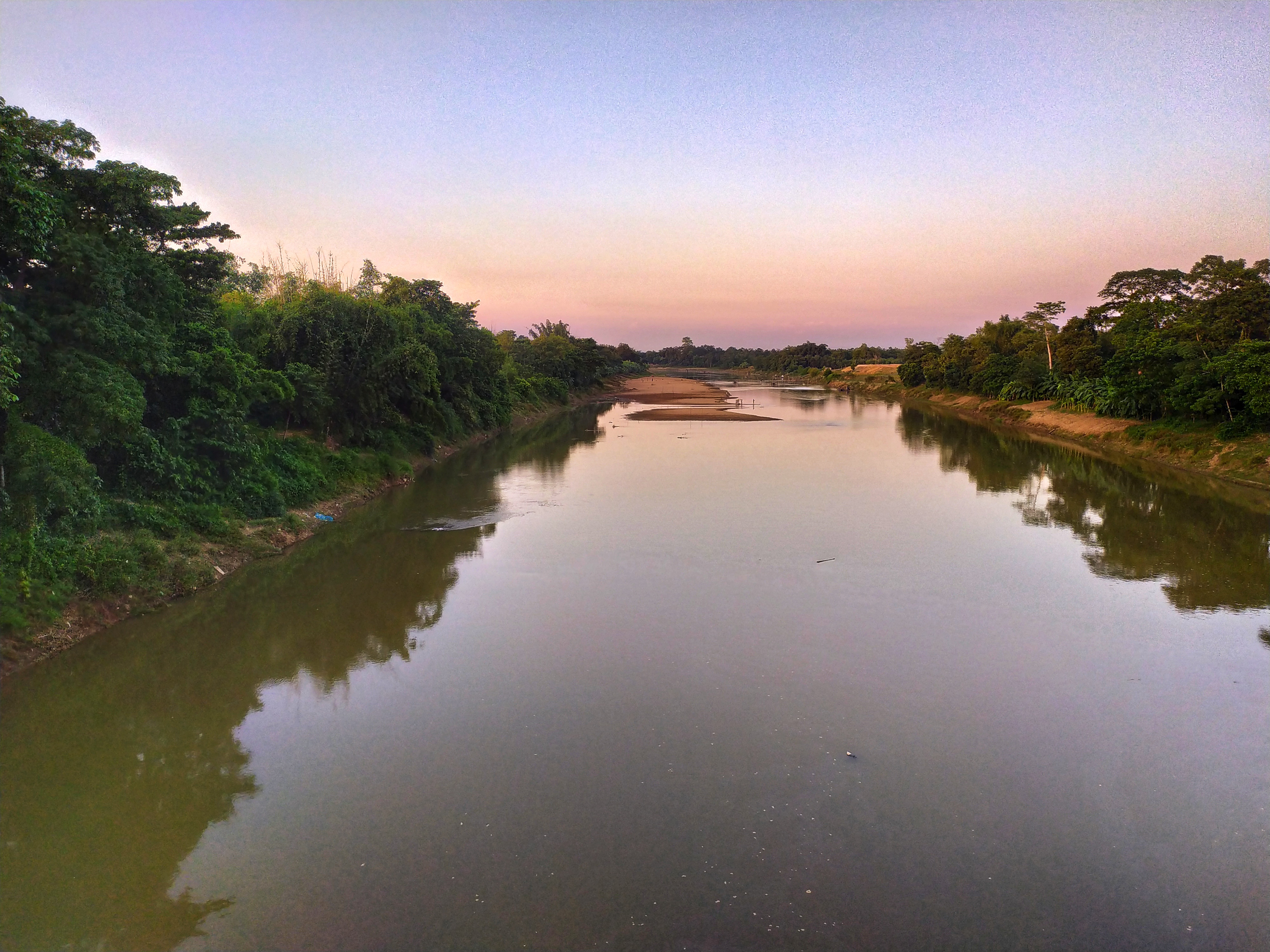
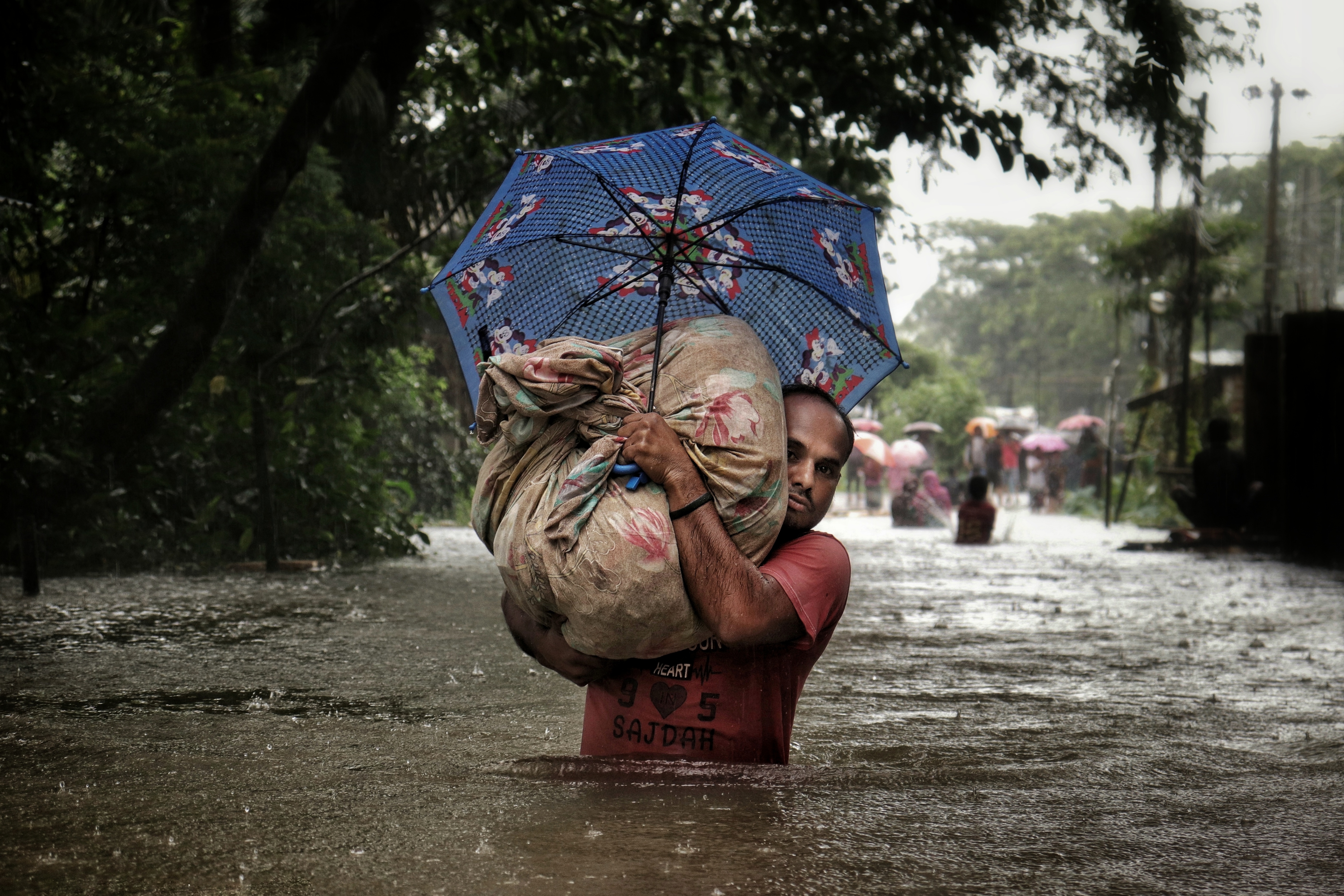
Floods in Moulvibazar damaged 3,932 mud and semi-pucca houses in four upazilas of the north-eastern district, the district relief and rehabilitation office said on Wednesday, 15 July 2026. Of these, 2,493 houses were completely damaged and 1,439 partly damaged, leaving many families in Kamalganj, Rajnagar, Kulaura and Moulvibazar Sadar without a sound roof in the middle of the monsoon.
Affected residents told Jagonews24 that upstream hill runoff and heavy rain had flooded 28 unions in Kamalganj, Rajnagar, Kulaura and Sadar upazilas, and that many mud and semi-pucca houses had collapsed in the water. The report, filed from Moulvibazar that evening, came a week after the district's hill rivers had broken through their embankments in several places.
Houses counted by the district relief office
The house count came from the district relief and rehabilitation office, the district office of the government's disaster relief administration, which also reports the number of affected families, shelters and relief allocations during a flood. Its list covered the same four upazilas the residents named: Kamalganj, Rajnagar, Kulaura and Moulvibazar Sadar. Every house on it was of one of two kinds, kutcha (mud or otherwise temporary) or semi-pucca, and the office divided them into houses that were completely damaged and houses that were partly damaged.
Rasel Mia, a resident of Rajnagar upazila, described what that meant for one family. "One side of my house collapsed in the flood. I don't have money even to eat properly. How will I repair the house?" he told Jagonews24.
District relief and rehabilitation officer Mohammad Chhadu Mia said corrugated iron sheets, rice, cash and dry food had been distributed among the flood-affected people. Corrugated iron sheets are the usual roofing of semi-pucca houses and of many kutcha houses in Bangladesh, so they are among the first things a family needs to put a damaged home back under cover.
Earlier in the week the same office's published figures had dealt with people: on 11 July the relief officer put the number of affected families at 9,998, about 38,172 people, in 42 unions and three municipalities of four upazilas, The Daily Star reported. The residents quoted on 15 July spoke of 28 flooded unions.
A week of breached embankments on the Dhalai and the Manu
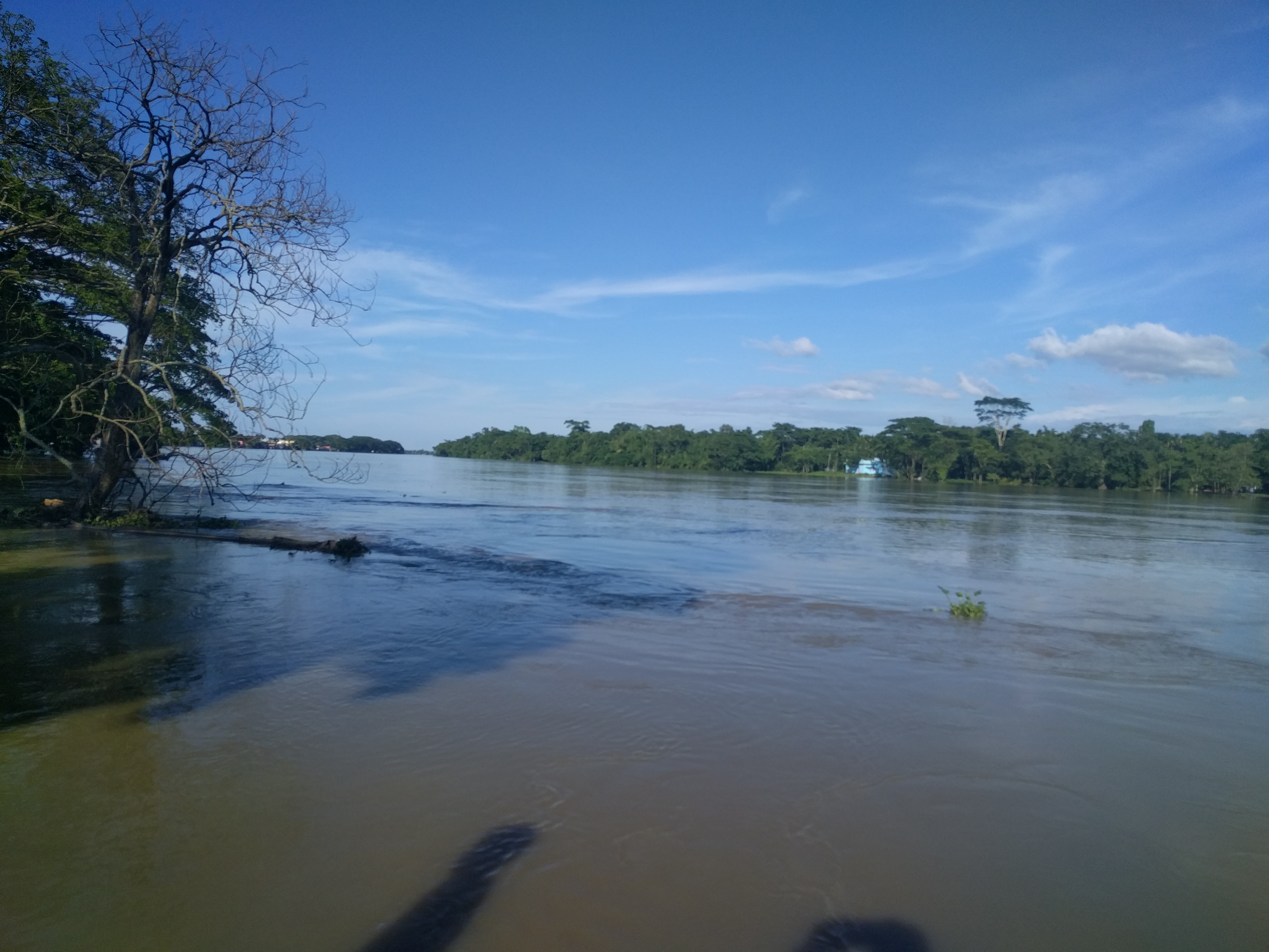
The flooding began on the Dhalai River. On the night of Wednesday 8 July a section of its flood-protection embankment gave way at Mokhabil in Islampur union of Kamalganj upazila, near the border with India. Dhaka Tribune reported on 9 July that at least 25 villages in Islampur, Adampur and Madhabpur unions were under water and about 10,000 people were stranded, with the Dhalai flowing 33 centimetres above its danger level. The Islampur-Adampur main road was submerged, floodwater had entered at least eight educational institutions, among them Bhandarigaon High School, where classes and exams were suspended, and aus paddy fields lay under three to four feet of water.
Local residents blamed the Bangladesh Water Development Board (BWDB) for not repairing the vulnerable Mokhabil stretch in time. The board's executive engineer in Moulvibazar told Dhaka Tribune that repair work had begun at the site but could not be completed because of obstruction by India's Border Security Force, and that an earlier repair had been washed away by the current.
On Thursday 9 July the Manu River broke through its embankment at Ujirpur and Haripasha in Tengra union of Rajnagar upazila. The Daily Inqilab reported that residents and officials had tried from the morning to hold the embankment before the rising water breached it. The Daily Star's Bengali edition listed Ujirpur, Haripasha, Ibrahimpur, Kanchari, Ekamdhu, Kandirkul and Panditnagar among about 20 villages flooded, and named Ramvadrapur, Salan, Paikpara, Defalaura, Ganeshpur, Akua, Konagaon, Tagarpur and Bhangarhat as villages at risk.
The rain behind it was heavy and sustained. The Sreemangal weather office recorded 186 millimetres in two days, the Inqilab reported on 10 July, and the BWDB executive engineer said water was flowing over many parts of the Manu embankment and that four or five more points were at risk. That evening the Manu stood 71 centimetres above its danger level at the Chandnighat bridge in Moulvibazar town and 70 centimetres above it at the Manu bridge in Kulaura. A 70-year-old man from Akua village in Tengra union was swept away by floodwater near his home; his body was recovered on the morning of Friday 10 July, The Daily Star and bdnews24 reported.
bdnews24 reported on 10 July that Aman rice seedbeds and farmland had gone under water, that thousands of people had spent the night in schools and with relatives, and that boats had become the only means of travel in many areas. The district administration said 148 shelters had been prepared across the district and would be opened as needed.
By the afternoon of 11 July the district relief officer's figures, as The Daily Star reported them, showed about 1,958 people in 19 shelters. Some 1,750 packets of dry food, Tk 5 lakh in cash and 5 tonnes of rice had been allocated, 50 educational institutions were closed and 11 medical teams were at work. A culvert on the Madhabpur road had broken at Goalbari inside Nurjahan tea garden. The Manu was then falling at its railway bridge point, though still 4 centimetres above the danger level, and stood 24 centimetres above it at Chandnighat, while the Kushiyara at Sherpur was 5 centimetres below its danger level, according to the BWDB.
Why kutcha and semi-pucca houses are the ones that fall
Houses in Bangladesh are classified by the materials they are built from, as Banglapedia, the national encyclopedia published by the Asiatic Society of Bangladesh, describes. There are four categories:
- Jhupri (shacks), made of jute sticks, tree leaves, jute sacks and similar materials.
- Kutcha (temporary) houses, made of mud brick, bamboo, sun-grass and wood, occasionally with corrugated iron sheets as roofs.
- Semi-pucca (semi-permanent) houses, with walls partly of brick, cemented floors and roofs of corrugated iron sheets.
- Pucca (permanent) houses, with brick walls and concrete roofs and a life span of over 25 years.
Jhupri and kutcha houses are counted as temporary and semi-pucca houses as semi-permanent. The kutcha house is the dominant type in rural Bangladesh, while pucca and semi-pucca houses dominate in towns, the encyclopedia notes. Every house on the Moulvibazar list belonged to the two middle categories, the houses of most village families.
Rebuilding is harder than it looks. Banglapedia records that housing problems in Bangladesh are made worse by the difficulty of obtaining building materials at affordable prices, and that traditional local materials such as timber, bamboo, straw and leaves have become scarce. Mud is still widely available, but it becomes expensive when it has to be bought and carried far. That is the background to Rasel Mia's question of how he would repair his house.
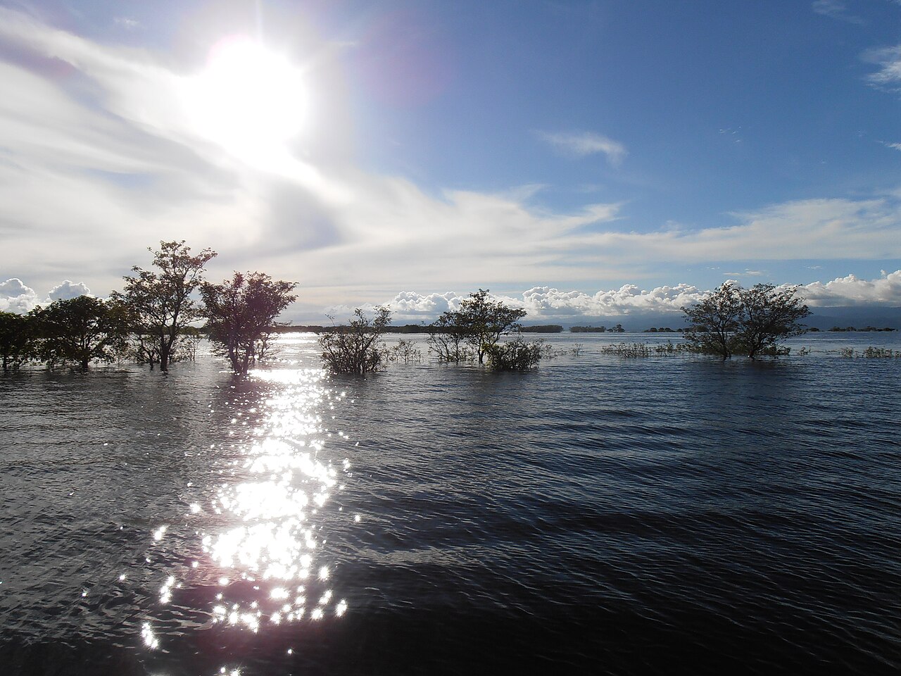
In haor country, floodwater is not the only danger to a house. Banglapedia's entry on haors notes that during the rainy season the haors turn into a vast inland sea in which villages appear as islands, and that occasional high winds between July and September raise large waves that can cause considerable damage to homesteads.
Hill rivers from Tripura: the Manu, the Dhalai, the Juri and the Kushiyara
Moulvibazar is bounded by Sylhet district on the north, the Indian state of Tripura on the south, Assam and Tripura on the east and Habiganj on the west, and its main rivers are the Manu, the Dhalai, the Juri and the Longla, according to Banglapedia. The Manu, the Dhalai and the Juri all rise in the hills of Tripura across the border.
The Manu is a trans-boundary river and a tributary of the Kushiyara. It rises under the Kahoisib peak of the Sakkanklang range in Tripura and, for some distance, runs through narrow gorges between walls of bare rock often 30 metres high or more. On reaching the plain it becomes a broad, slow, meandering stream. It enters Bangladesh through Kulaura upazila, turns northwest and then north, and meets the Kushiyara at Manumukh in Moulvibazar Sadar upazila.
The Dhalai is the main river of Kamalganj upazila. It comes down from the hills of Tripura, which border Kamalganj on the south, crosses Kamalganj and joins the Manu in Rajnagar upazila. The two rivers thus drain neighbouring parts of the district, Kamalganj and Rajnagar, where the two breaches of July 2026 happened.
The Juri also rises in the north-eastern hills of Tripura and enters Bangladesh in Kulaura upazila. It flows north along the international boundary, crosses Kulaura, runs through Hakaluki Haor and turns west into the Kushiyara. Its reach inside Bangladesh is about 56 kilometres long.
The Kushiyara carries water from beyond the border on a larger scale. The Barak of India divides at Amalshid on the north-eastern edge of Zakiganj upazila in Sylhet into the Surma and the Kushiyara, and about 85 percent of the Barak's flow runs through the Kushiyara. The river is about 161 kilometres long, about 250 metres wide on average and up to 10 metres deep in the rainy season, and it passes Rajnagar and Moulvibazar. Its highest measured discharge at Sherpur, the point the BWDB used in its July 2026 readings, is 3,700 cubic metres a second.
Banglapedia divides Bangladesh's floods into three types: monsoon floods, which rise and fall slowly over wide areas; flash floods, in which the water rises and falls suddenly, generally in the valleys of hilly areas; and tidal floods. The hill catchments draining into the north-east are characterised by flash floods that are mostly short but unpredictable in frequency and intensity, and several floods can come down these rivers in a single year. Downstream, the Sylhet depression, where the Surma and the Kushiyara join to form the Meghna, fills rapidly early in the monsoon and drains slowly.
Embankments are the main defence. Among the large irrigation projects that include flood embankments, Banglapedia lists the Manu River project, with about 50 kilometres of embankment along the Manu and the Kushiyara. The Manu barrage in Moulvibazar Sadar is listed among the district's landmarks.
Haors that fill in the monsoon
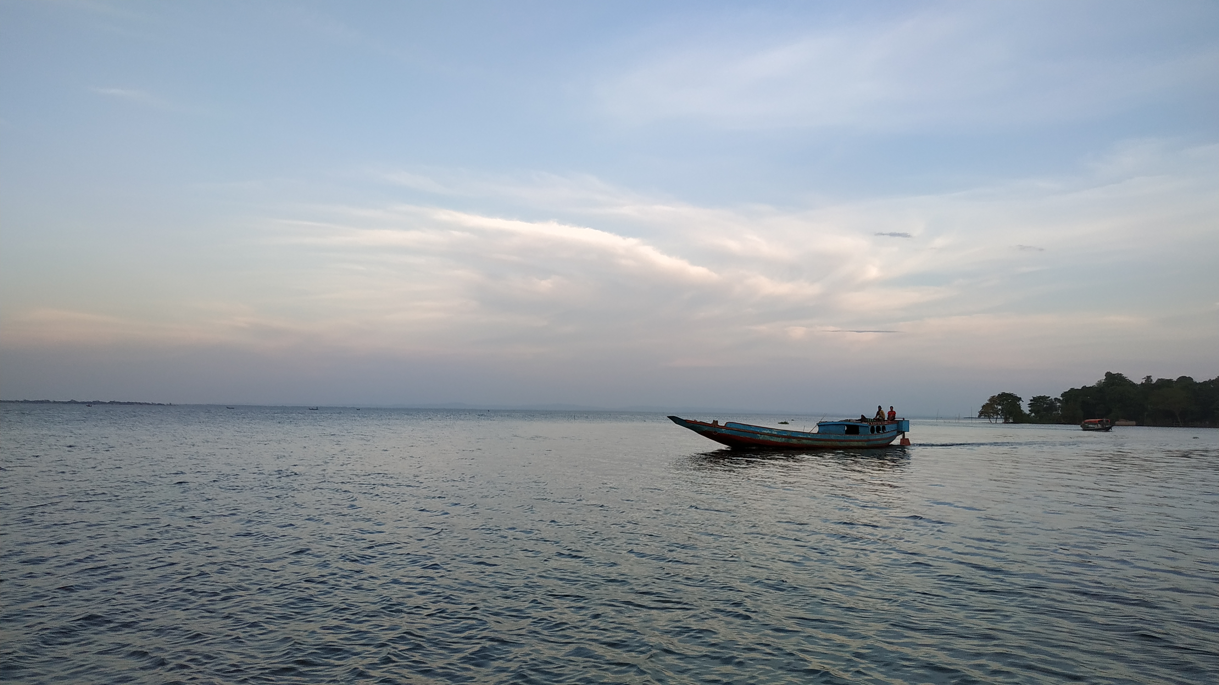
A haor is a large, bowl-shaped tectonic depression that receives runoff from rivers and canals, becomes a very extensive body of water in the monsoon and largely dries up afterwards, Banglapedia explains. The haor basin of north-eastern Bangladesh is bounded by the hills of Meghalaya on the north, Tripura and Mizoram on the south and Manipur on the east, and rivers rising in those hills can flood it to a depth of up to six metres. Moulvibazar's notable haors are Hakaluki, Hail and Kawadighi.
Hakaluki Haor is the largest haor in Bangladesh and one of the larger wetlands in Asia. It spreads over five upazilas, three of them in Moulvibazar (Kulaura, Juri and Barlekha) and two in Sylhet district (Golapganj and Fenchuganj), and covers about 181.15 square kilometres, about 40 percent of it in Barlekha. It contains more than 238 interconnected beels, some perennial and some seasonal. With the rains the haor floods to about 18,383 hectares and stays under water for up to five months, when all its beels merge into one large lake.
The haor is fed by the Juri or Kantinala, the Sonai or Bordol, the Damai, the Fanai and the Kuiachara rivers; the Bordol or Sonai and the Juri or Kantinala rise in India. About 200,000 people live around the haor and most of them depend on its resources. Because the haor floods every year, settlements are clustered along its slightly raised fringes. The government declared Hakaluki an Ecologically Critical Area under the Bangladesh Environment Conservation Act in 1999.
Rajnagar, one of the four upazilas in the July 2026 count, has the Kawadighi Haor and the Farakka and Pukhuri beels among its water bodies, alongside the Manu, the Dhalai and the Kushiyara.
The four upazilas in the count
Moulvibazar district covers 2,799.38 square kilometres and has seven upazilas. At the 2011 census it had 1,919,062 people, and agriculture was the main source of income for 40.37 percent of households, according to Banglapedia's district entry. Manipuri, Khasia, Tripura and Halam communities live in the district.
Kamalganj covers 485.26 square kilometres, has nine unions, among them Islampur, Adampur and Madhabpur, and had 259,130 people at the 2011 census. Its main river is the Dhalai. Its main crops are Aman and aus paddy, wheat, sugarcane, tea, mustard, potato, betel leaf and vegetables, and agriculture was the main income of 39.77 percent of households. Lawachhara, declared a national park, lies in the upazila.
Rajnagar covers 338.15 square kilometres, has eight unions, among them Tengra, where the Manu broke through on 9 July, and had 232,666 people in 2011. Agriculture was the main income of 51.61 percent of households, and its main crops are paddy, tea, potato, mustard, ginger, turmeric and vegetables. The upazila had 140 kilometres of pucca road, 30 kilometres of semi-pucca road and 278 kilometres of mud road.
Kulaura, where the Manu enters Bangladesh, covers 545.73 square kilometres, has 13 unions and had 360,195 people in 2011. The Manu is its main river, Tripura lies on its south, and it has 33 tea gardens. Moulvibazar Sadar covers 344.32 square kilometres, has 12 unions, among them Chandnighat and Manumukh, and had 342,468 people in 2011; its main rivers are the Manu and the Barak, and the Manu's Chandnighat gauge stands at the district town.
Floods the district had seen before
Moulvibazar had been flooded by the same rivers in each of the two years before July 2026. In June and early July 2024 the Kushiyara, the Juri and the Manu rose above their danger levels. On 3 July 2024 Dhaka Tribune, carrying a UNB report, put the number of stranded people at about 300,000 in five upazilas; the district primary education officer said 133 educational institutions were under water, 94 of them primary schools, and 64 of the flooded primary schools were being used as shelters. The Kushiyara was then 17 centimetres above its danger level at Sherpur, the Manu 26 centimetres above at Chandnighat and the Juri 184 centimetres above, according to the BWDB.
In August 2024 a second flood came down the Manu and the Dhalai. On 22 August 2024 Dhaka Tribune reported 212 villages flooded across 37 unions and municipal areas, with the district administration counting 122,687 people affected in seven upazilas. The Manu embankment had been breached at Kadamhata in Rajnagar and in several places in Tilagaon union of Kulaura, and the Manu stood 118 centimetres above its danger level at Chandnighat. By 25 August 2024 the district administration's figure had risen to 237,095 affected people in seven upazilas, with 8,561 people in 47 cyclone centres, and embankments had been breached at 20 to 22 places, the paper reported.
In 2026 the July flood was not the district's first. In early May, The Daily Star's Bengali edition reported on 4 May 2026, about 530 millimetres of rain fell on Moulvibazar in a month when about 300 millimetres is normal, about 300 millimetres of it in three days, according to the BWDB's executive engineer. An embankment on the Lawachhara canal collapsed and flooded villages in Adampur union of Kamalganj, and rising water hampered the boro harvest in the haors of Juri and Kulaura. Juri's agriculture officer said the upazila had 6,170 hectares under boro; Kulaura's said 380 of its 8,720 hectares of boro were already waterlogged.
Floods in the region are recorded far back. Banglapedia's chronology notes a serious flood in 1781 that was most marked in western Sylhet, when cattle suffered from loss of fodder, and the flood of 1786, when the parganas of Sylhet were entirely under water, most of the cattle drowned and the survivors were kept on bamboo rafts. Across Bangladesh, about 26,000 square kilometres, 18 percent of the country, are flooded in an average year, and more than 55 percent can go under water in a severe flood.
Who watches the rivers and who brings relief
The Bangladesh Water Development Board, whose Moulvibazar office reported the river levels in July 2026, was created in 1972 from the water wing of the former East Pakistan Water and Power Development Authority and has been governed since 2000 by the Bangladesh Water Development Board Act. Its tasks include building and maintaining embankments, barrages and regulators for flood control, drainage and irrigation, and the forecasting and warning of floods and droughts. The board's Flood Forecasting and Warning Centre issues the national flood bulletins.
Relief is the responsibility of the Ministry of Disaster Management and Relief and its Department of Disaster Management, which works under a legal framework that includes the Disaster Management Act 2012. The department's programmes, as its website lists them, include relief assistance, VGF food support, test relief, food and cash for work, flood shelters and bridges and culverts, along with allocations of rice and cash for flood relief. In a district these are handled through the deputy commissioner's office and the district relief and rehabilitation office, the office that counted Moulvibazar's damaged houses and distributed corrugated iron sheets, rice, cash and dry food in July 2026.
Rainfall is measured by the Bangladesh Meteorological Department, whose observatory at Sreemangal in Moulvibazar district recorded the rain of early July. On 9 July 2026 the department had forecast heavy to very heavy rain in eight divisions, Sylhet among them, Dhaka Tribune reported.
Photo: Rocky Masum / Wikimedia Commons (CC BY-SA 4.0)
Sources: Jagonews24 (15 July 2026), The Daily Star Bangla (10 and 11 July 2026, 4 May 2026), Dhaka Tribune (9 July 2026; 3 July, 22 and 25 August 2024), bdnews24.com (10 July 2026), The Daily Inqilab (10 July 2026), Banglapedia (Asiatic Society of Bangladesh), Department of Disaster Management

Comments
(0)