
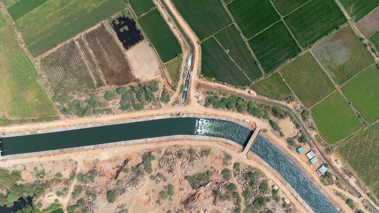
Water stored in a reservoir is no guarantee that it will reach a farmer at the far end of a canal, argues Selvamani Sampath, a junior GIS associate at WELL Labs, a Bengaluru water systems centre, in a column for Down To Earth marking GIS Day. The views are the writer's own.
India's canals carry water from rivers and reservoirs to millions of hectares through main canals, distributaries, laterals and field channels. Because the network is connected, a single silted channel, an unseen breach or overgrown weeds upstream can cut off farms downstream. Main lined canals get most of the money and attention, the writer says, while the last stretch, where water actually enters the fields, is barely monitored and often not even mapped. Manual inspections can take months, and by the time a fault is reported a whole irrigation cycle may be lost.
Geographic Information Systems let farm plots, canals, crops and soil be viewed as layers on one map. Combined with drone mapping and artificial intelligence, they can show the network as it really is, pick out structural damage and trace how water moves. A drone survey can image field channels in days rather than months. In Karnataka's Raichur district, an assessment in the Tungabhadra Left Bank Canal command area found weed growth and damaged structures along a distributary that kept water from farms downstream.
The real gain, Sampath writes, comes when the data reach farmers. Today spatial data stay with technical specialists. A few trained members of each Water User Association, able to read maps, use GPS-based apps and record damage, could help farmers judge irrigation demand and ask departments for water based on actual need; WELL Labs' Jal Vigyani programme is testing the idea. Kerala, Uttar Pradesh and Gujarat are already exploring drone canal surveys, Karnataka collects crop data through its Bele Samikshe digital crop survey, and India-WRIS, run by the Central Water Commission and ISRO, publishes open water datasets.
The column proposes three steps. Water resources, agriculture and revenue departments should join their data at the level of the farm plot and share it with water user cooperatives. Before each seasonal release, trained association members should work with irrigation engineers and state remote sensing centres on drone surveys of distributaries, with AI flagging weeds, silt and breaches so repairs are done before water flows. And maps should be checked against farmers' own knowledge, as electronic participatory rural appraisal meetings did in Raichur, with that local information built into maintenance budgets and release plans.
Better maps alone will not deliver water, the writer concludes; departments, local administrations and farmers have to use the information together to decide when water is released and which channels need repair.
Photo: Vraj Acharya, WELL Labs / Wikimedia Commons (CC BY-SA 4.0)
Source: Down To Earth

Comments
(0)