
Two fields lie side by side in one village, with only a narrow earth bank between them. After the monsoon, water drains from the first within days, and its soil soon turns dry and crumbly. Next door, water is still standing, and a foot sinks deep into mud. While the first farmer ploughs for a winter crop, the second is still waiting for the water to leave. They share a village, a sky and the same rain, yet their farming calendars are different.
Behind that difference lies the long history of a river. Over a very long time, the Brahmaputra has dropped silt across this land, and it has not spread evenly. In some places it built up higher ground. In others it left low hollows, or old river channels that are now half filled. Together, the height of the land, the type of soil and the way water moves decide what each field can do.
On Bangladesh's farming map, this land is the Young Brahmaputra and Jamuna Floodplain, Agro-Ecological Zone 8, or AEZ-08. The country is divided into 30 such zones, grouped by their landforms, soils, water and climate, so that planners can see what is likely to grow well and where. The Bangladesh Agricultural Research Council's Fertilizer Recommendation Guide of 2024 puts this zone at 592,394 hectares. That is about 5,924 square kilometres, or roughly 1.46 million acres.
The name is easy to confuse with its neighbours. AEZ-07, the Active Brahmaputra-Jamuna Floodplain, is the land of shifting river islands, where sandbars rise and wash away. AEZ-09 is the Old Brahmaputra Floodplain. AEZ-08 is neither. Its defining feature is not riverbank erosion but variety: high and low land, different soils, and water that causes a different problem from one field to the next.
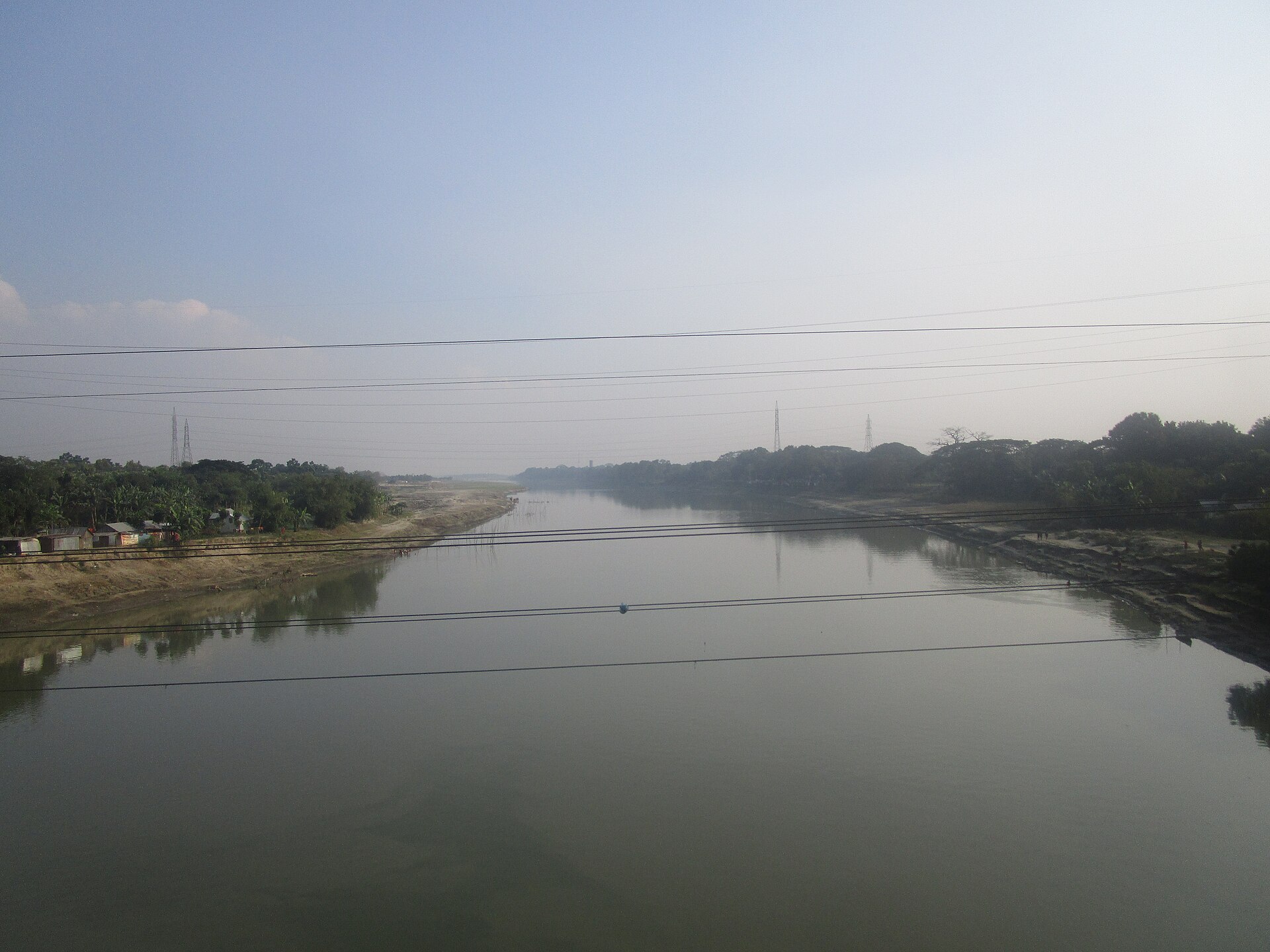
A river moved and left a pattern behind
To understand this zone, it helps to look back. The research council's guide says the main flow of the Brahmaputra shifted into its present Jamuna channel about 200 years ago. Its older course did not vanish. The Old Brahmaputra, which still flows past Mymensingh, is a trace of that earlier river.
The guide describes AEZ-08 as an area of Brahmaputra sediments with a complex surface: broad and narrow ridges, hollows between those ridges, old channels that have been cut off and partly filled, and basins. A basin is simply land lower than its surroundings, where water runs in and collects. The ridges are the raised strips between them.
It is not hard to see how the ridges form. When a river overflows during the monsoon, the water spreads out and slows down. The heavier particles settle first, close to the bank. Year after year, those deposits build a strip of slightly higher land beside the channel. The finest mud is carried further, into places where the water lies still, and there it settles as heavy clay.
So this is not one flat plain, even if it can look that way from the road. The land may seem level to the eye, but the monsoon water soon shows which field sits where.
Where the zone lies and how far it reaches
The guide lists eight major districts for AEZ-08. The largest share is in Jamalpur, with about 94,300 hectares. Mymensingh follows with about 86,100, then Kishoreganj with 77,600 and Manikganj with 71,000. Sherpur has about 17,400 hectares, Munshiganj 13,400, Narsingdi 9,300 and Narayanganj 5,600.
Together, those eight account for about 374,700 hectares, or some 63 percent of the zone. The table does not break down the remainder by district. Other regional land-resource descriptions also mention parts of Tangail, Dhaka and Gazipur.
A warning belongs here. A district's name on this list does not put the whole district in the zone. By the same guide's figures, about 33,800 hectares of Jamalpur fall in AEZ-07, 94,300 in AEZ-08 and 67,100 in AEZ-09. That is three different farming zones within a single district. To know which zone covers a particular upazila, union or village, the official map has to be checked.
The headline figure also deserves some care. The 592,394 hectares is a published reference, not a fresh measurement made in 2026. Maps from different periods and changes to administrative boundaries can shift such numbers slightly.
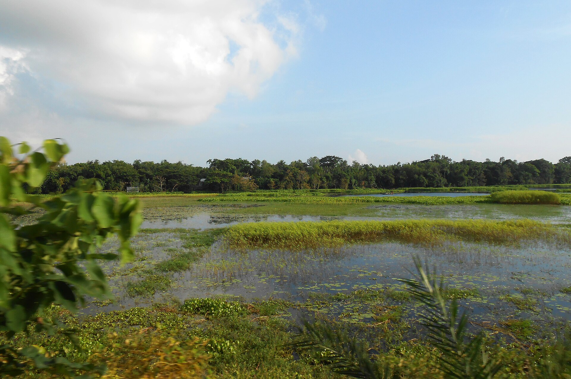
High land, middle land and low land
Bangladesh usually classifies farmland by how much water reaches it in the monsoon. Normal floods do not cover highland. Medium highland floods up to about 90 centimetres deep, medium lowland from 90 to 180 centimetres, and lowland from 180 to 300 centimetres.
According to the guide, 18 percent of AEZ-08 is highland, 42 percent medium highland, 19 percent medium lowland and 9 percent lowland. The remaining 12 percent is homesteads and water bodies. In other words, normal floods stay off about one-sixth of the zone, while more than a quarter can sit under water from about a metre to as much as three metres deep.
For a farmer, those categories have a practical meaning. Water leaves high land quickly, so preparation for a winter crop can begin early. Water stays much longer on low land, which can push back ploughing, sowing and harvesting. Farmers in one village, in one season, may therefore be working to quite different calendars.
Light soil and heavy clay
The soil changes along with the height of the land. Ridges usually carry silt loam to silty clay loam, soils that let water pass through. The basins hold heavy clay, which water can hardly penetrate. The guide calls the ridge soils permeable and the basin clays impermeable, and it describes grey floodplain soils as the zone's main soil type.
The difference is easy to feel. Squeeze a handful of damp loam and it breaks apart without much effort, while clay sticks together like dough. Roots spread easily through loam, but it holds less water. Clay holds much more water, yet it is hard to plough when wet and turns hard when dry. In some places a layer of sand lies not far below the surface, so water and roots may behave differently from what the topsoil suggests.
Soil acidity matters as well. It is measured on the pH scale, where 7 is neutral and lower numbers mean more acidic soil. The guide says soils in this zone range from strongly acidic to neutral: pH 4.3 to 7.2 on highland, 4.5 to 7.4 on medium highland and 4.6 to 7.6 on medium lowland. That is a wide range for one zone. In very acidic soil, many crops struggle to take up the nutrients already there, so it pays to know the figure for one's own field.
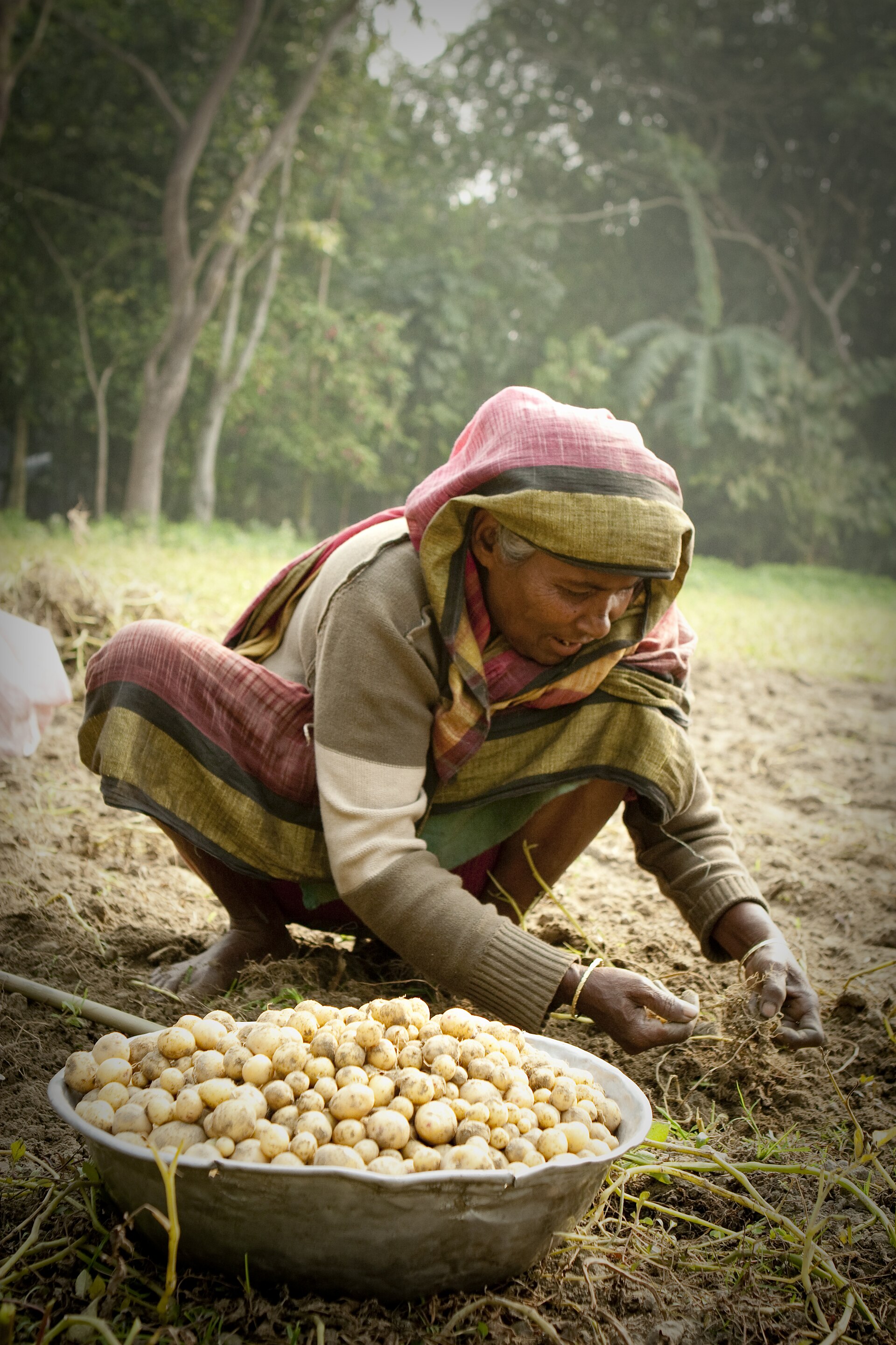
What the soil lacks, according to the guide
Crops feed mainly from the soil. The 2024 guide says soils in AEZ-08 are mainly deficient in nitrogen, phosphorus, potassium, sulphur, zinc and boron. On all three of the main land types listed, nitrogen, phosphorus, zinc and boron range from very low to low. Potassium ranges from low to medium. Sulphur is low to medium on highland, but very low to low on medium highland and medium lowland.
Organic matter is low to medium. This is the rotted material in soil, from leaves, straw, roots and manure. It does more than feed plants: it keeps soil crumbly, helps it hold water and supports useful soil life. On high ground that drains quickly, low organic matter can leave crops short of water in the dry season.
Some older regional descriptions rated potassium and zinc as medium. That gap with the latest guide points to something bigger: regional averages cannot set the fertiliser plan for any one field. Two neighbouring plots can differ in their nutrient levels, depending on the previous crop, past fertiliser use and how long the land stayed under water.
The safest route is a soil test and advice from the local upazila agriculture office. Unneeded fertiliser adds cost and can harm the environment, while a missing nutrient can hold back yields even when other fertilisers are applied. Crop residues, compost and other local organic materials can improve soil, but the right amount depends on the soil, the crop, the season and the drainage.
Matching crops to the land
Regional farm descriptions list several monsoon-season crops for this zone: broadcast and transplanted Aus rice, transplanted Aman rice, jute, green-manure crops and foxtail millet. The winter list includes wheat, potato, mustard and Boro rice. None of this means that every field can grow every crop. The lists are only a first guide to what may be possible.
High land drains quickly, so it suits crops that cannot tolerate standing water. Medium highland allows planning around rainfall and available water, for rice or other crops. On low land, the main question is how long the water will stay, since that decides when seedbeds can be prepared and seedlings transplanted.
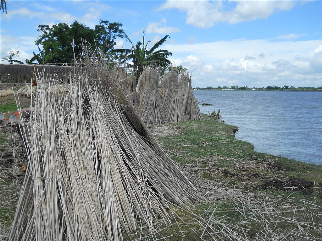
Each crop brings its own sums as well. Boro rice depends on irrigation, so the first questions are whether water will be available and what it will cost. Aus and Aman depend on the timing of the rains, soil moisture and the arrival of floods. Jute needs clean water nearby for retting, the soaking that loosens its fibre, and without it the profit can look quite different.
Tobacco also appears in some older crop lists. Its presence there is not a recommendation. Choosing a crop should also involve health, the environment, markets and government policy, along with profitable alternatives. In the end, the right choice for a farmer depends on all of these together: the height of the land, the soil, the water, access to irrigation and what buyers want.
One field needs water, another needs to lose it
Water is not a single problem in this zone, and that may be its most striking feature. High fields lose water quickly and may need irrigation in the dry season. Low basins can collect too much monsoon water, which can damage crops and delay land preparation. So a blanket call for more irrigation, or for more drainage, would miss the point. What solves the problem at one end of a village could create one at the other.
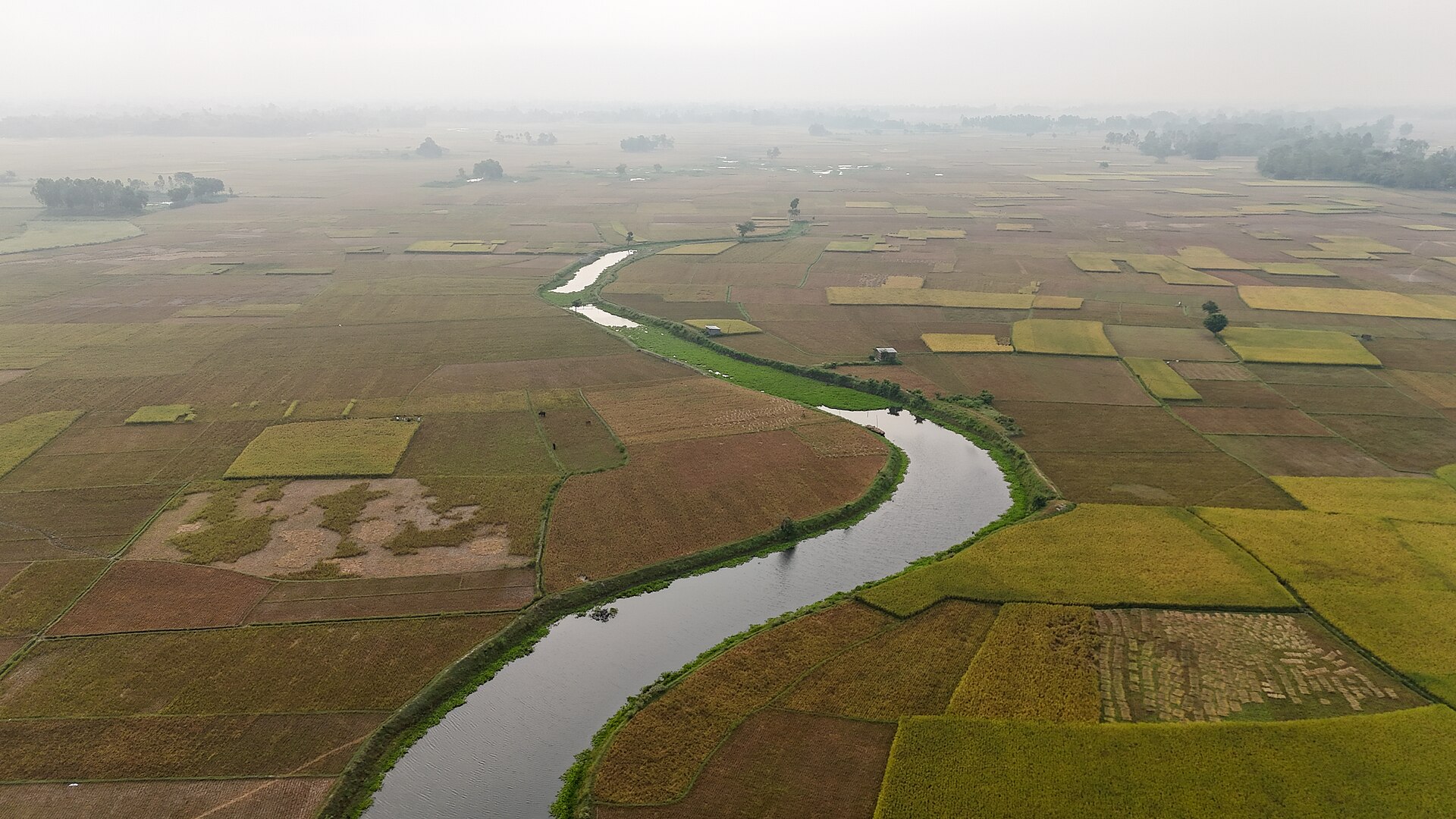
Canals, drains, ponds, old river channels and natural water paths all play a part. Where water can be stored safely, it may help irrigate crops in the dry months. Where its way out has been blocked, a carefully planned outlet may reduce crop losses. But digging one drain or closing one path affects the neighbouring fields, and also fish and other water life. Any such work has to take account of local structures and the natural balance.
Erratic rainfall and sudden heavy downpours have made this planning more important. Even so, judging the risk in a particular place takes long-term weather records, flood data and observations from the field. A zone's name alone cannot tell you that.
The old river channels
In parts of this zone, former river channels have been partly filled in. From above, they may look like ordinary rice fields, but their soil and water behave differently from the higher land around them. In some, water collects during the monsoon. In others, settlements, roads or other structures may narrow the way out and cause waterlogging.
It is worth marking these channels and basins in any farm plan. One part of a village may suit a crop that tolerates wet conditions, while another may be better for a crop that needs less water. Without information on land height and water movement, such differences are hard to see from a distance.
This is where farmers' experience counts. Villagers know from long observation where water collects, how long it stays, which way it leaves and when a field can be ploughed again. When that knowledge is set beside a map, the map becomes far more useful.
What satellite images can and cannot show
Images from satellites can show which land is under water, where crops are growing, and where rivers and water bodies lie. Comparing pictures from different dates can show where water is lingering and where land use is changing.
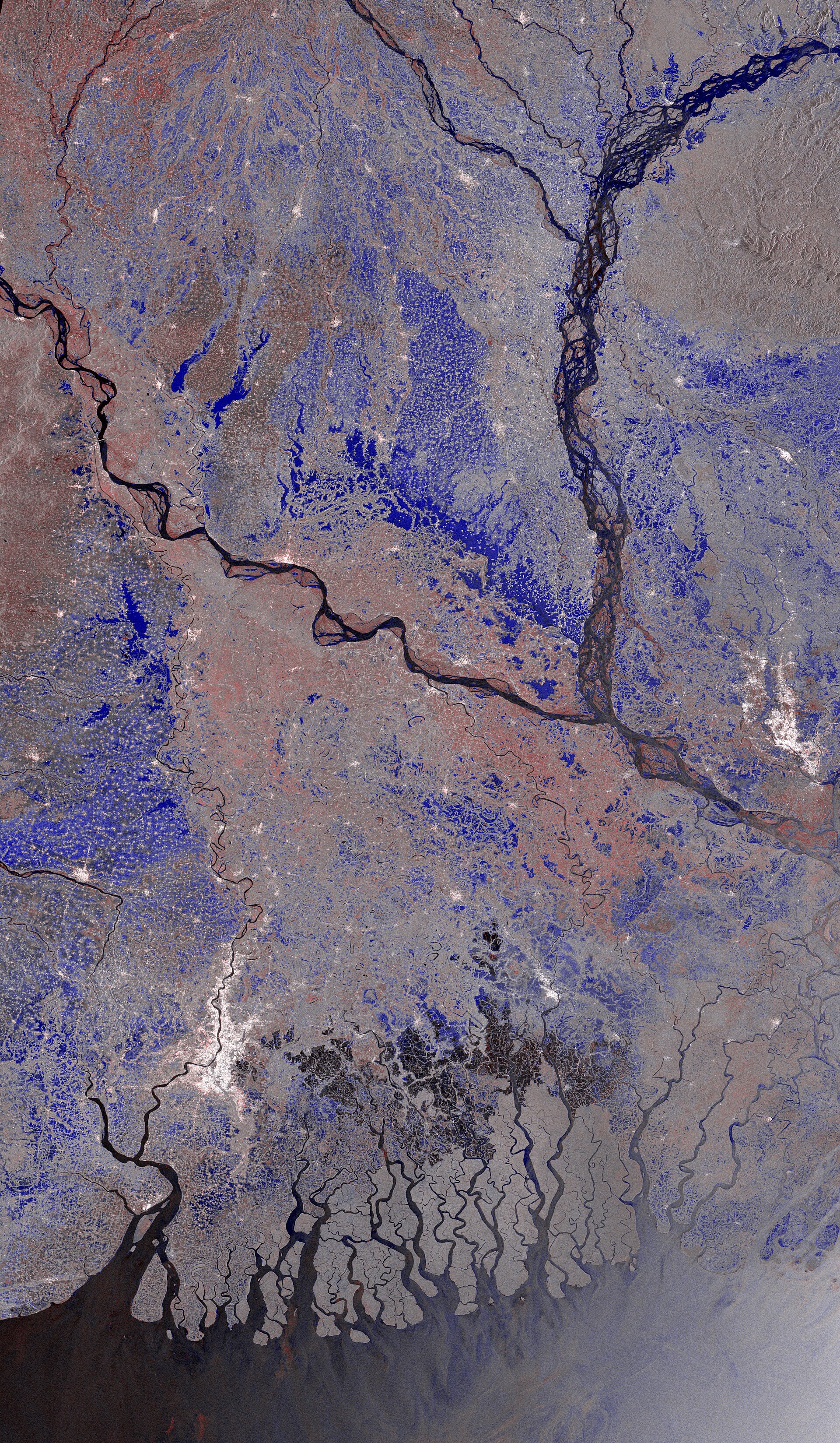
But satellite images have limits. One image cannot reveal the real amount of nitrogen or phosphorus in a field, and it cannot promise what a crop will yield. That takes soil samples, weather data, crop histories and observations on the ground.
Digital farm services that bring this information together could be useful to farmers and field staff. By combining a field's location, height, soil, drainage, weather and crop calendar, they might offer advice for that particular field. The research council's Crop Zoning Information System, which shows layers such as soil, land type, drainage and agro-ecological zones, is one example of such a resource. Still, no app or model should be treated as the final word. Its advice has to be tested in real fields, and the limits of its data should be stated openly.
Why village averages are not enough
A major research question here is the variation within a single village. District or upazila averages often cannot explain what is happening on one farm. Researchers need to record how the soil, water and crops differ between ridge tops, slopes and low basins in the same place.
Several measurements would help: land height and shape, soil type and pH, organic matter, main nutrient levels, how many days each year water stands on the land, which crops are grown, how much irrigation they need, and how the harvest turned out. Collected with clear dates and locations, these details would give a far more reliable picture of the zone.
The sources need care too. Government maps, soil records, weather data, satellite images and field observations often cover different periods and different scales. Before combining them, it is important to check what each one means and where its limits lie. Results from a few fields in one village cannot speak for the whole zone. Farmers' accounts belong in this work too, because they often notice problems that broad regional data miss.
Research that helps a farmer decide
Research earns its value when a farmer can use it to make a decision. Which crop suits this field in this season? Where should water be drained, and where should irrigation come first? Which nutrient shortage should be dealt with first? The answers have to come from local conditions.
The Young Brahmaputra and Jamuna Floodplain therefore needs two kinds of knowledge at once: official maps and soil data on one side, and village fields and farmers' experience on the other. Satellite images and digital tools can help join them, but advice that has not been checked in the field remains incomplete.
Think again of those two fields at the start. The farmer ploughing on one side of the bank and the farmer waiting for the water on the other are both right. Their land is different, so their plans should be too. Treating this whole region as one farm would waste what makes it valuable. Taking each field on its own terms is the surer way to get more from this river-made soil.
Comments
(0)