
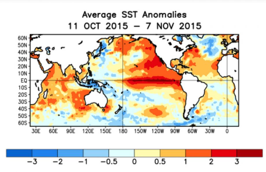
A powerful pulse of warm water stretching thousands of miles, known to scientists as a 'Kelvin wave', is moving through the Pacific towards the coast of California, according to a photo story in Ei Samay. Oceanographers describe it not as an ordinary wave but as a vast 'planetary wave'.
It forms when the Pacific trade winds weaken and warm water that had been pushed to one side sloshes back. It is closely tied to El Nino, which heats the tropical Pacific well above normal; that extra warm water travels as a wave beneath the surface.
Oceanographer Mike Jacox said such waves do not break or foam like beach waves and cannot be seen, but they warm the upper ocean and temporarily raise sea levels along the coast. When normal high tides or storms arrive, the water can climb higher, sharply increasing the risk of coastal flooding and damage.
The report says California governor Gavin Newsom has declared a state of emergency, with rescue teams on standby for possible winter storms and surges, and the California Coastal Commission has advised residents in flood- and landslide-prone areas to check drainage and secure their homes.
Scientists at the US National Oceanic and Atmospheric Administration (NOAA) said the effects will appear first on the southern California coast and could then spread north to Oregon and Washington. The story is by Ei Samay's Rohit Paramanik.
Photo: NOAA / Wikimedia Commons (public domain); Pacific sea-surface temperature anomalies during the 2015 El Nino
Source: Ei Samay

Comments
(0)