
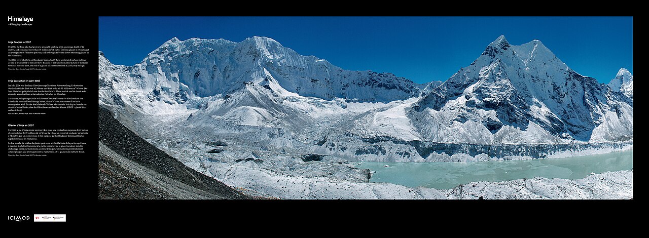
Nepal plans to lower the water in four high-mountain glacial lakes after recent floods killed more than 1,400 people, with work to start this fiscal year, Desh Rupantor reported, citing Reuters. In August a glacier collapse triggered landslides and flash floods along the Nepal-China border; more than 5,000 people are still missing.
Subas Tuladhar of Nepal's Centre for Hydrology and Water Resources Research, who leads the project, said the aim is to reduce the risk of the lakes' natural dams bursting and of floods downstream. Channels will carry water in a controlled way to nearby rivers, though workers spending long periods at altitude will face health risks and the danger of flash floods.
The project covers Thulagi, Lower Barun, Lumding Tsho and Hongu-2 lakes in central and eastern Nepal, at 4,050 to 5,483 metres above sea level, listed among the country's most dangerous glacial lakes in a 2020 report by UNDP and ICIMOD. Design and detailed surveys are to begin within the fiscal year ending in mid-July.
The project, estimated at about $50 million, will be funded by the Green Climate Fund, UNDP and the government of Nepal. It also includes sensors to monitor the lakes, flood forecasting and warning systems, and help for low-lying communities to prepare for disasters. Nepal lowered Tsho Rolpa lake by about three metres in 2000 and Imja lake near Everest about a decade ago.
Nepal has had about 26 glacial lake outburst floods in four decades, and extreme weather and climate disasters kill more than 300 people a year on average. The latest floods damaged about a dozen hydropower plants, roads, bridges, farmland and settlements; officials say early recovery alone may need about $5 billion. At the United Nations, Prime Minister Balendra Shah called the disaster a warning to the world.
This report is based on reporting by Desh Rupantor, citing Reuters.
Photo: Etter Studio / Wikimedia Commons (CC BY 2.0)
Source: Desh Rupantor

Comments
(0)