
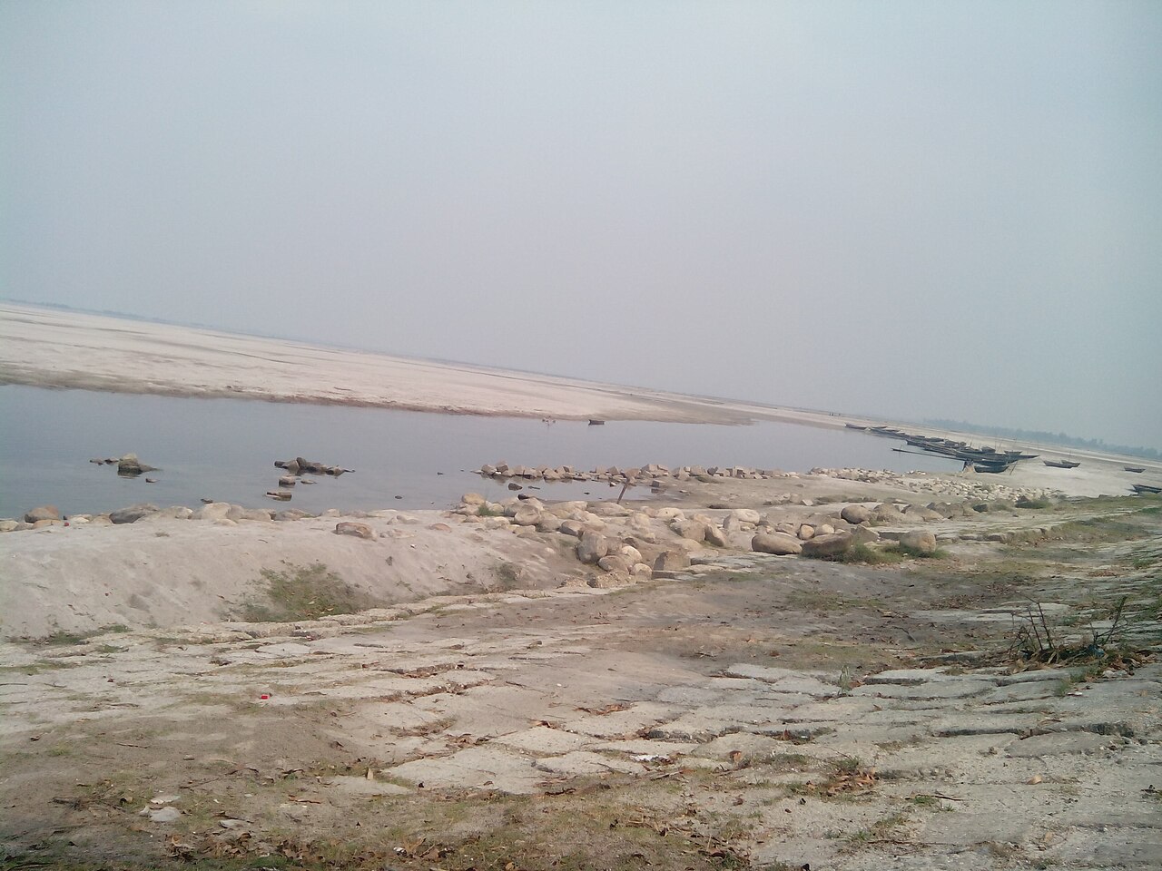
Stand on the bank of the Teesta on a winter morning and the river can seem to have gone somewhere else. Where brown water raced past in August, a plain of pale sand now runs out towards a thin, slow channel. On it, in neat green rows, stands young maize. A little further on there are potatoes, onions, chillies, a patch of pumpkins. A few hundred metres away lies a field that was under water only a few months ago, its surface still streaked with the marks the flood left behind.
This shifting scene is one of the most familiar pictures of river farming in northern Bangladesh. It is also the defining feature of a small but unusual part of the country's farm map: the Active Tista Floodplain, the second of Bangladesh's 30 agro-ecological zones, known as AEZ-2.
According to the Bangladesh Agricultural Research Council's (BARC) Fertilizer Recommendation Guide 2024, the zone covers 83,644 hectares. It is made up of the active floodplains of three rivers, the Teesta, the Dharla and the Dudhkumar, and runs as narrow belts inside and beside their channels through Kurigram, Lalmonirhat, Nilphamari, Rangpur and Gaibandha. Kurigram holds the largest share, about 32,900 hectares, followed by Lalmonirhat with 14,800, Nilphamari with 14,200, Rangpur with 11,600 and Gaibandha with 5,100.
Those figures describe the zone on paper. They do not capture what makes it different, which is that here the river gives land and the river also takes it away.
What makes AEZ-2 a zone of its own
An agro-ecological zone is an area where the things that matter most to crops are broadly alike: the shape of the land, the soil, how deep and how long the land floods, and the length of the growing seasons. BARC uses the zones to tailor fertiliser advice and crop planning, so that a farmer in the far north is not handed the same prescription as one on the coast.
AEZ-2 stands out because it is not a settled plain. BARC describes a complex pattern of low, generally smooth ridges, hollows between them, river channels and old channels the river has cut off and left behind. Most of the area floods only shallowly, but at the peak of the rainy season the water can run much deeper.
Almost three quarters of the zone, 72 per cent, is classed as medium highland. In plain terms, that is land that normally goes under less than a metre of water in the monsoon: wet enough to shape what can be grown and when, but not permanently drowned. Another 26 per cent is homesteads and water bodies, and only about 2 per cent is highland that stays above the usual flood.
When the river builds new land
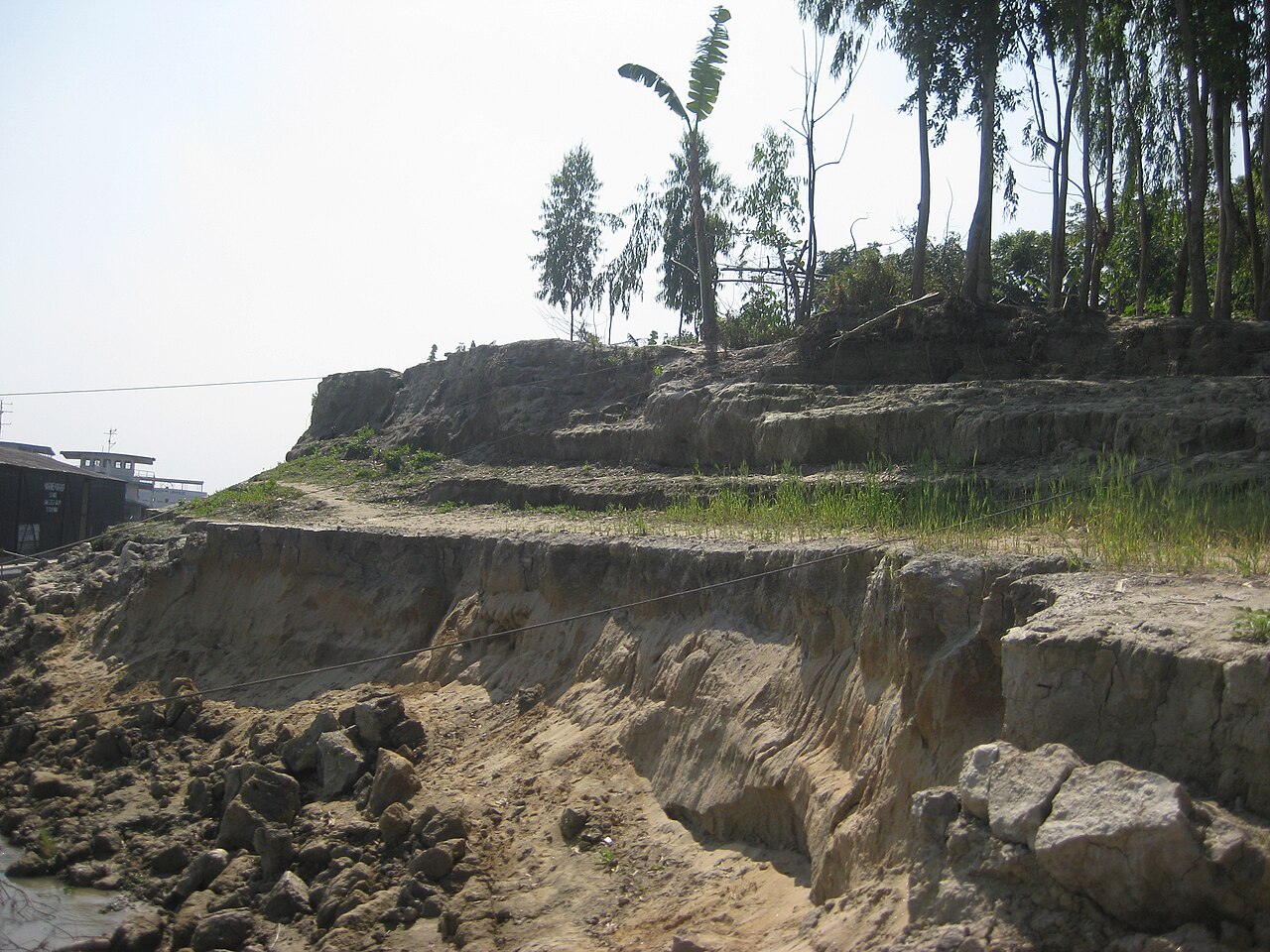
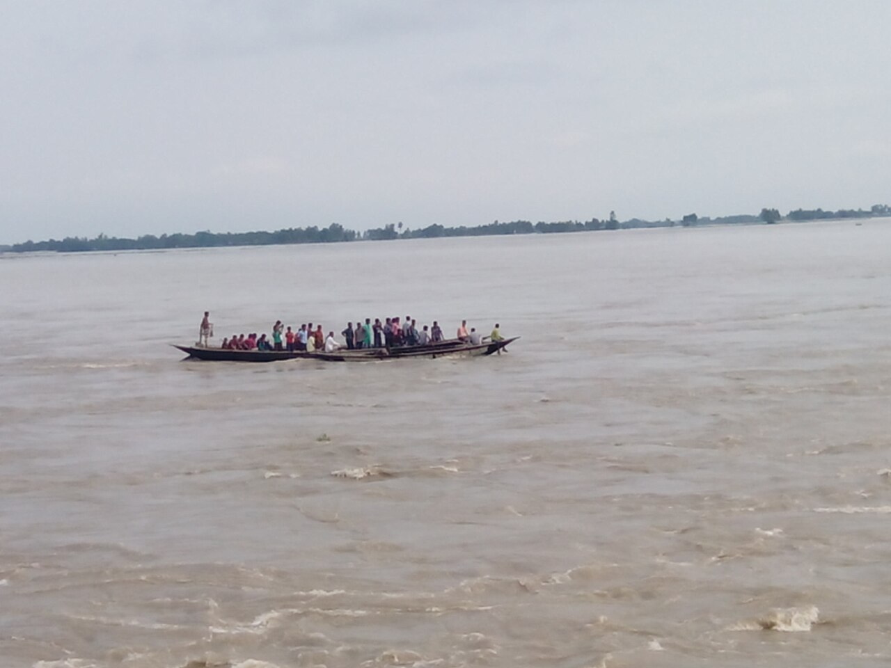
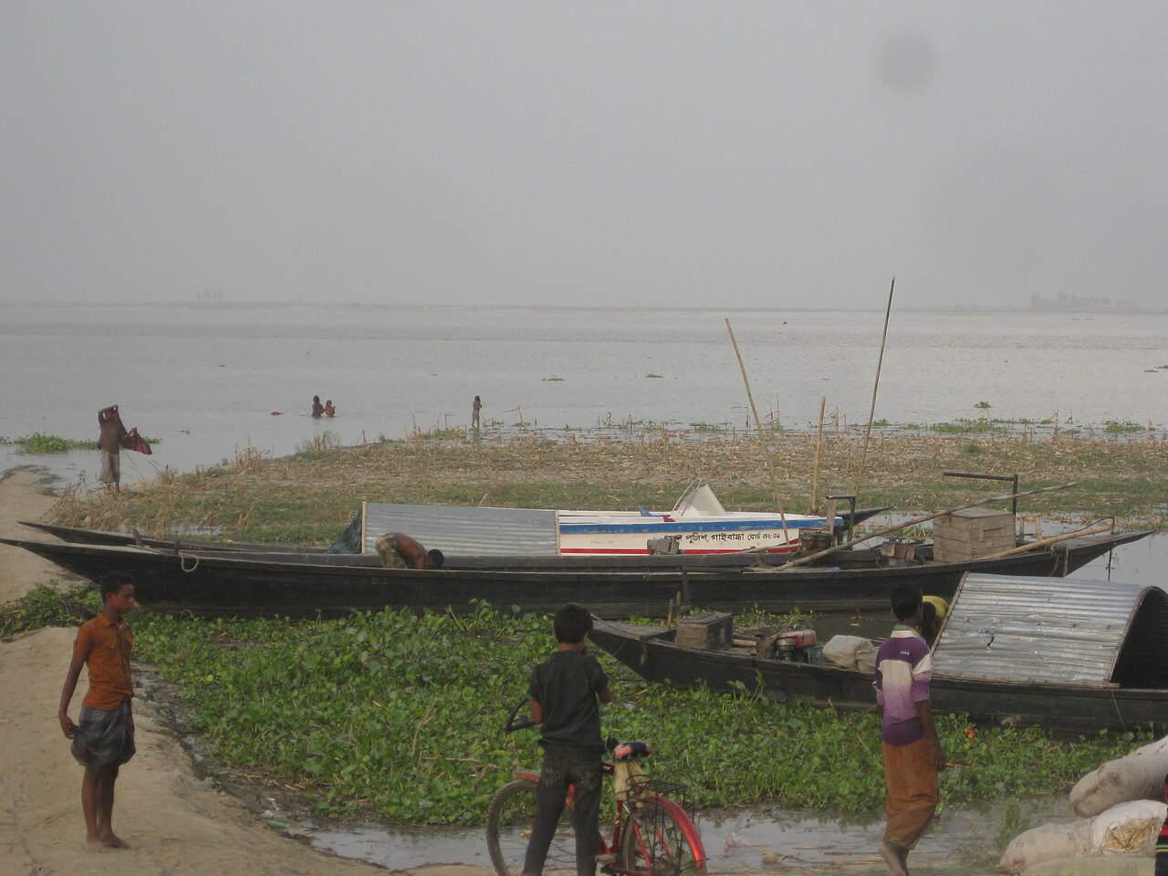
For families living beside the Teesta, the river is part of daily life rather than a feature on a map. In the monsoon the water rises. Banks may give way. An old field can disappear in a night. Elsewhere, as the water falls, a new char, a sandbar or river island, rises out of the channel.
At first a new char looks like little more than sand. Over the seasons, however, the river lays silt over it, grasses take hold, and some chars become fit to farm. Across Kurigram, Lalmonirhat, Rangpur and Gaibandha, farmers have spent years learning to grow maize, potatoes, chillies, pumpkins, onions, garlic, groundnut, wheat and rice on land like this.
The lesson matters. A newly risen river island is not necessarily wasted ground. With the right crop and careful management, it can become a source of food and income for households that often have little other land.
And when the same river takes it back
The hardest truth of char farming is uncertainty. The river that builds a field can also bury it.
In October 2024, The Daily Star reported that floods had left vast stretches of farmland in 40 unions across 13 upazilas of Lalmonirhat, Kurigram, Rangpur, Gaibandha and Nilphamari buried under sand. In some places the sand lay two to three feet deep over fields that had been planted with Aman rice.
"One bigha of my land is now covered with sand," Sadekul Islam of Gatiashyam village in Kurigram told the newspaper. "Five years ago, two bighas were buried in sand, and I still can't grow anything there." Dhiren Barman of Gangachara in Rangpur described the slow hope that follows: if fresh silt settles over the sand, a bumper crop can come, but it takes years.
For a farmer the meaning is plain. A field standing in rice or maize today can look entirely different after one unusually large flood, or after the channel swings a few hundred metres to one side. And when the water goes down, a new piece of land may appear somewhere else. That constant movement is what sets farming in AEZ-2 apart from farming on more stable ground.
Grey sand and thin soil
The river does not only move land; it makes the soil. Floodwater carries sand, silt and minerals, and when the current slows, some of that load settles on banks and chars. Each flood lays down a new layer, which is why the soils of AEZ-2 are far from uniform.
BARC describes irregular patterns of grey, stratified sands and silts, meaning soil built up in visible layers of coarser and finer material. Four general soil types occur in the zone. The most common is what soil scientists call non-calcareous alluvium: young river deposits that contain no lime. They are rich in minerals that will slowly weather and release nutrients, but they are still young and hold little.
The guide's figures show how thin that fertility is. Organic matter, the decayed plant and animal material that holds water and feeds soil life, is very low to low. Shortages of nitrogen, phosphorus, potassium, sulphur, calcium, magnesium, zinc and boron are common. On the zone's medium highland, all of these except potassium are rated very low to low.
Acidity matters too. Soil pH measures how acidic or alkaline soil is, with 7 as neutral. On AEZ-2's medium highland it ranges from 4.4 to 6.3, strongly to slightly acidic, and acid soil can lock up nutrients even when they are present.
All of this has a practical consequence. A farmer who copies the fertiliser a neighbour used may not get the same result, because two fields side by side can differ. One may be short of nitrogen, another of phosphorus or potash, a third of zinc or boron. Testing the soil before deciding is more reliable than guessing.
Winter harvests on the chars
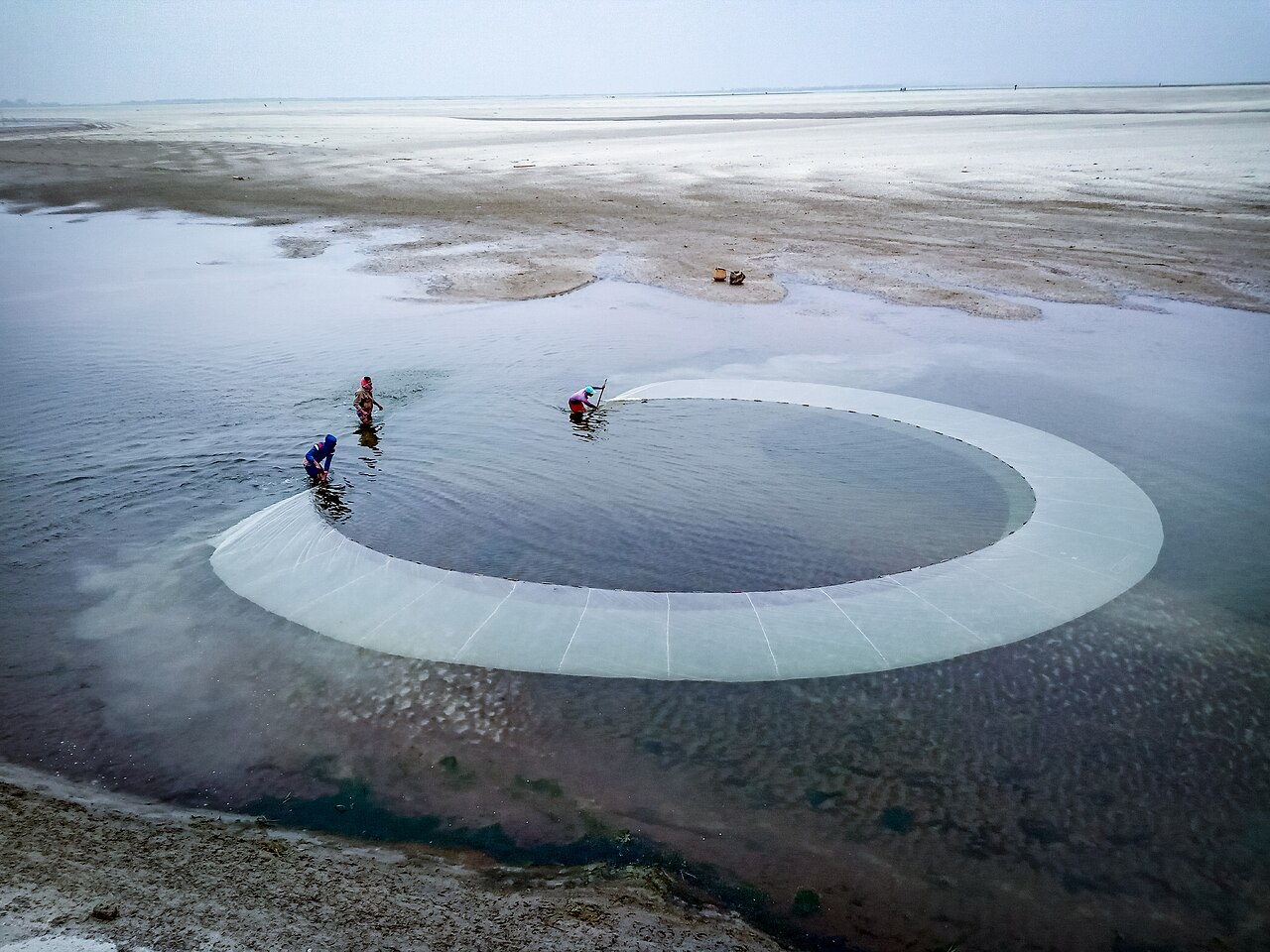
It would be wrong, though, to picture the Teesta chars only as places of flood and erosion. When the river shrinks in the dry season, many chars turn into working farmland.
In parts of Gaibandha, land once thought too difficult to cultivate now carries chillies, maize, pumpkins, potatoes, onions and other winter crops, helped by fresh river silt and by farmers who have learnt the chars season by season. In Lalmonirhat, vegetables and maize grow on the sandy islands of the Teesta.
Carrots show how far that can go. The Daily Star reported in 2023 that carrots were being grown on about 1,900 hectares across 30 chars of the Teesta in Lalmonirhat, Kurigram, Rangpur, Gaibandha and Nilphamari, with each hectare yielding about 30 tonnes. Ayub Ali, a madrasa teacher at Char Kalmati in Lalmonirhat Sadar, leased 8.5 acres for the crop and harvested about 110,000 kilograms.
The value of a piece of land, in other words, can change with time. Ground that looks barren today may be good farmland in a few seasons.
Why maize took hold
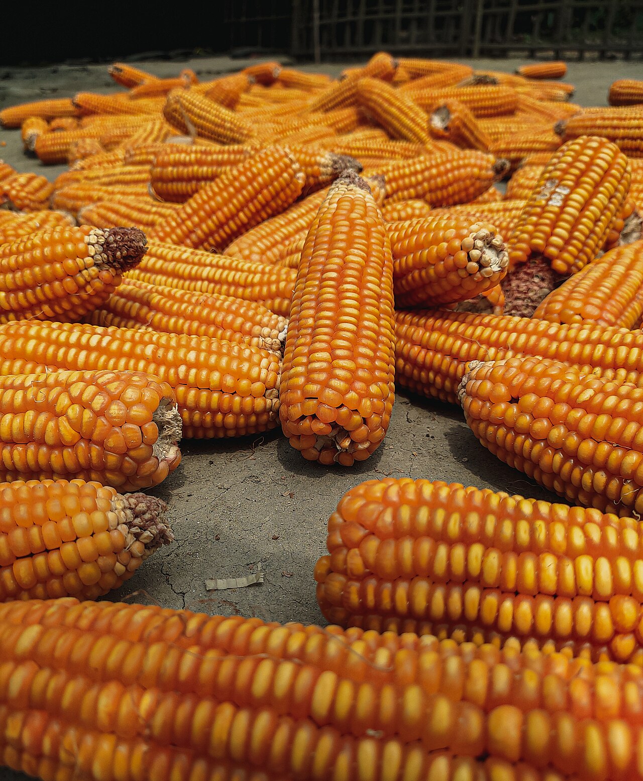
Maize is the clearest example of how farmers have adapted to the chars. It tolerates sandy ground, fits the dry-season calendar and has a ready market in the poultry and fish-feed industries.
In March 2025, The Daily Star spoke to maize growers on the Teesta in Lalmonirhat. "We have become self-reliant by cultivating maize," said Dilbar Hossain, 60, of Char Shoulmari in Kaliganj upazila. "Maize traders and feed company representatives buy directly from us." At Char Gaddimari in Hatibandha, Nazar Mahmud had widened his maize from 10 bighas to 15, with traders paying him in advance.
Examples like these are encouraging, but they are not proof that the same result will follow on every char. Each char has its own soil, its own water, its own distance from the channel and its own risks. The variety sown, the planting date, irrigation, fertiliser, labour and the price at harvest all shape the final return.
Too much water, then too little
Water brings a second, stranger challenge. In the monsoon there is too much of it; in the dry season, too little.
When stretches of the Teesta turn shallow or dry up, char farmers have to pump groundwater to keep their crops alive. The Daily Star has described farmers in Lalmonirhat running diesel shallow pumps for potatoes, maize and other crops when the river water is gone. Those who can afford a pump pay more to produce; those who cannot may lose the season.
For the farmer, then, water has two faces. In the rainy months the task is to survive the excess. In the dry months it is to find enough. Farming here has to answer both.
The barrage at Doani
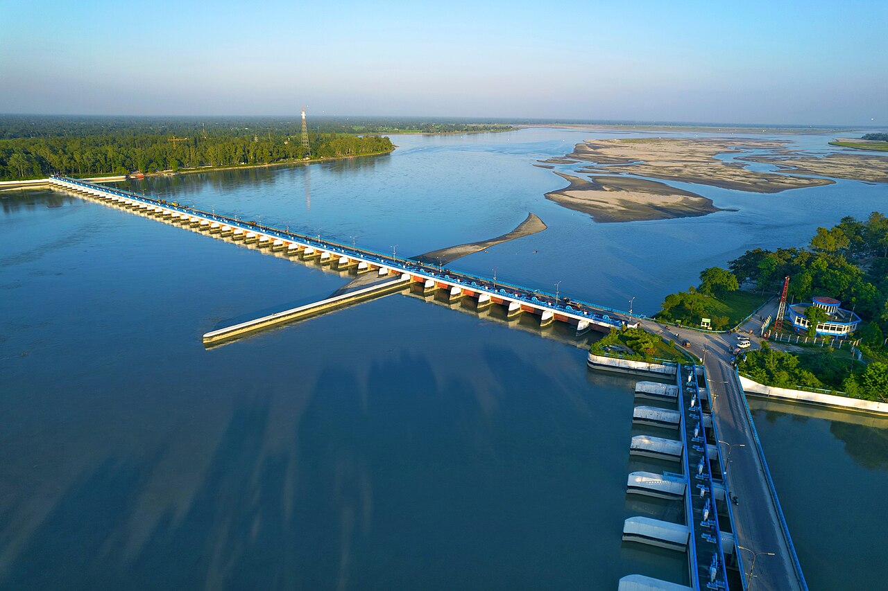
Any account of water on the Teesta runs into the Teesta Barrage, which spans the river between Doani in Hatibandha, Lalmonirhat, and Dalia in Dimla, Nilphamari. According to the Bangladesh Water Development Board, the project was built to support irrigation, flood control and drainage and to raise farm output across the north. The 615-metre barrage, with 44 gates, was completed in the late 1990s and feeds a large network of irrigation canals.
Yet water across a big river basin cannot be managed by one structure. Rainfall, river flow, groundwater, the height of each field, the choice of crop and the timing of planting all decide how much water a farm needs and when. Understanding how those pieces fit together is the basis of better planning.
Three farmers, one zone, three different problems
Imagine three farmers in the same village beside the Teesta. The first farms land right at the river's edge. The second has a field a little further back. The third works a plot on slightly higher ground.
All three live inside AEZ-2. Their risks are not the same. For the first, erosion may be the greatest threat. For the second, it may be how often and how long the field floods. The third may lose soil moisture fastest and depend most on irrigation, and on its cost.
This is why information about the zone as a whole cannot explain every farm within it.
Why village records matter
An agro-ecological zone gives the broad picture. A farmer needs to know about one particular place. If long-term records were kept village by village, researchers could start answering far more useful questions. How long did the flood last this year, and how deep was it? Where did the bank give way, and where did a new char rise? What was planted, what was harvested, what did irrigation and fertiliser cost, and what did the crop fetch at market?
Kept over many years, such records would make the changing pattern of a village's farming far clearer. A long-term agricultural database for AEZ-2 could hold:
- the village and the exact location of each field;
- soil acidity, organic matter, nitrogen, phosphorus and potassium, and micronutrients such as zinc and boron;
- soil moisture and the height of the land;
- flood depth and duration, distance from the river and bank erosion;
- rainfall, temperature and irrigation;
- crop, variety, planting and harvesting dates, yield and output;
- fertiliser and pesticide use, pests and diseases;
- production cost, market price and satellite readings of crop condition.
Much of the frame already exists. BARC's spatial database holds information on soil texture, drainage, soil series, relief, slope, pH, moisture, nutrient status, salinity, permeability and hazards, and its agro-ecological and cropping-pattern databases record crop sequences, sowing and harvest dates and whether crops are irrigated or rain-fed. Linking those regional datasets with detailed village and field observations would give research a much stronger footing.
Reading the river from space
Satellite images are especially useful in a zone like this, because rivers, chars, water and farmland all move. Comparing pictures of the same village taken over ten years can show where the channel shifted, where new chars formed, where farmland was lost, where new farmland appeared, and how crops grew from one season to the next.
Scientists also use measures such as NDVI, the Normalised Difference Vegetation Index, which reads how green and vigorous plants are from the light they reflect. It can track a crop's growth from above.
But a satellite cannot see everything. A field that looks green in an image does not tell anyone how much grain came off it. For that, someone still has to go to the field and measure.
Can a harvest be forecast?
AEZ-2 also offers a chance to test whether yields can be forecast village by village. Suppose researchers had ten years of rice records for one village. They could combine them with rainfall, temperature, soil conditions, irrigation, the length of floods, the varieties grown, planting dates and satellite observations, and test machine-learning models, computer programs that learn patterns from past data, to estimate future harvests.
A model's answer is not the final word. Say it predicts 4.5 tonnes of rice per hectare and the farmer harvests 3.6. The gap becomes the next research question. Was there a flood? Did disease strike? Was irrigation late? Did the river rise without warning? Was fertiliser applied at a different time? Did the satellite catch the crop at the wrong stage of growth? Evidence from the field is what answers them, and each answer makes the model better.
From the trial plot to the farmer's field
Publishing research matters. Its real value shows when it is tested under real farming conditions. Suppose scientists develop a new crop variety for the chars and it performs well on a research station. The next step is to try it in several villages. It may thrive in one and fail in another.
Why? The answer may lie in the soil, the water or the planting date. It may be fertiliser, or disease, or even the market. Each difference opens a new question, and the work moves from research to the field and back again until the answer holds up where farmers actually live.
Opportunity with a price tag
The Active Tista Floodplain, then, is not only a zone of agricultural risk. It is also a zone of opportunity. New chars, planted with the right crops, can become productive land, and in the dry season farmers grow maize, potatoes, chillies, onions, garlic, pumpkins, carrots and groundnut on them.
Opportunity never comes free here. Floods can return. Sand can bury a field. Banks can collapse. Irrigation can cost more than expected, and prices can fall at harvest. Research for char farming has to weigh cost and risk alongside yield.
A path from the map to the field
One practical route for AEZ-2 runs as a chain: agro-ecological zone, village, field, data, research, field validation, farmer adoption, measurable impact. First understand the zone. Then see how its villages differ. Gather information from real fields, and let that evidence shape the research questions. Test the answers with farmers, watch whether they are taken up, and finally measure what changed in yield, cost, income, risk and the condition of the soil. That last measurement is what turns a finding into proof.
The Teesta is more than a river running through northern Bangladesh. For many communities it is bound up with land, water, crops, livelihoods and the years ahead. In the monsoon it spreads. Sometimes land disappears. When the water falls, new chars appear, and farmers return with seed, labour and experience. Some years the harvest is good. Some years a flood, a layer of sand or a sudden lack of water changes everything.
That is why AEZ-2 should not be read as just a coloured patch on an agricultural map. It needs village evidence, field observation and long-term records. With them, the second agro-ecological zone can become a scientific foundation for understanding the farming, risks, opportunities and changing lives of the people who live beside the Teesta and its sister rivers.
Cover photo: the Teesta Barrage and the river's sandbars in northern Bangladesh. Photo: Shafiul Islam Shaikot / Wikimedia Commons (CC BY 4.0)
Comments
(0)