
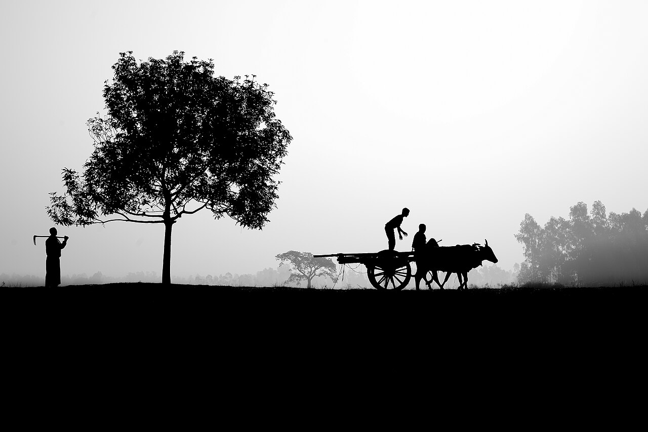
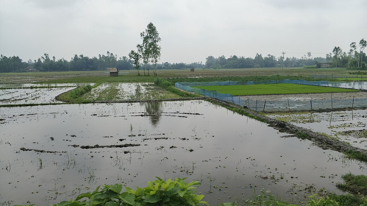
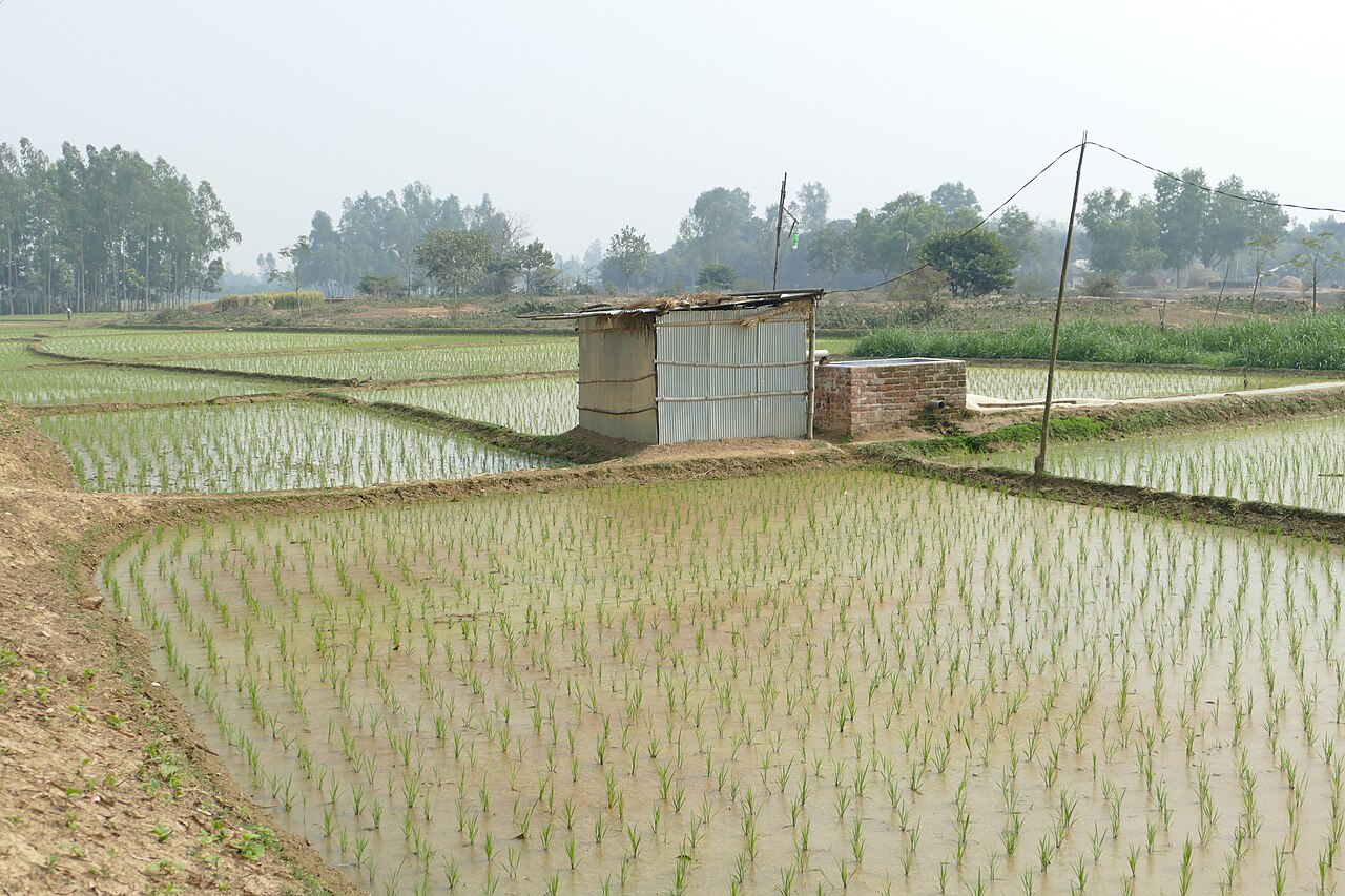
Before sunrise on a winter morning in Rangpur, the fields are still grey with fog. Bullock carts creak along the raised earth paths and the first farmers are already out. As the light comes up, the land reveals itself as a patchwork rather than a single sheet of green: a strip of young potatoes here, a yellow square of mustard there, a field of maize, and in the lower ground, flooded beds where rice seedlings wait to be planted out.
Walk a few hundred metres and the ground changes under your feet. One plot sits a little higher and dries within hours of a heavy shower. The next lies in a shallow dip and stays wet for days. To a visitor the difference is barely visible. To the farmer it decides what can be sown, when it can be sown and how much water and fertiliser it will need.
That everyday puzzle is the defining feature of the Tista Meander Floodplain, the third of Bangladesh's 30 agro-ecological zones and known to scientists as AEZ-3. It is one of the largest farming landscapes in the north of the country, and one of the most varied.
Where is AEZ-3?
An agro-ecological zone is an area where landform, soil, water and climate are similar enough for farming to follow broadly the same rules. The Bangladesh Agricultural Research Council (BARC) uses these zones to set fertiliser recommendations and plan research, because a district boundary says nothing about whether the land floods or how acidic the soil is.
According to BARC's Fertilizer Recommendation Guide 2024, the Tista Meander Floodplain covers 946,803 hectares, about 9,468 square kilometres. It takes in a large part of the Tista floodplain and the floodplains of the Atrai, Little Jamuna, Karatoya, Dharla and Dudhkumar rivers. That makes it more than eleven times the size of its narrow neighbour, AEZ-2, the Active Tista Floodplain, which follows the river's live channels.
The guide lists ten districts. Rangpur holds the largest share, about 171,900 hectares, followed by Nilphamari (148,900), Gaibandha (143,900), Dinajpur (112,700), Kurigram (95,700), Naogaon (94,800), Lalmonirhat (93,500), Panchagarh (30,000), Bogura (29,000) and Joypurhat (25,400). In practice that means most of greater Rangpur, the eastern side of Dinajpur and Panchagarh, and the northern edges of Bogura, Joypurhat and Naogaon.
The land and landscape of AEZ-3
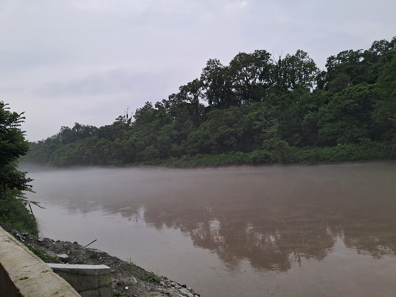
The word meander is the clue. Over a very long period, the Tista and its neighbours swung back and forth across this plain in looping bends, abandoning old channels and cutting new ones. Each shift left behind a pattern of slightly raised banks, called ridges, and broad, almost level hollows, called basins.
BARC describes most of the zone as broad floodplain ridges and almost level basins. In places, especially alongside the rivers, the relief becomes irregular, with narrow ridges, depressions and old channels that have filled in with sediment. These differences may amount to only a metre or two of height, but on a floodplain a metre decides how long water stands on a field.
Highland and medium highland
Bangladesh classifies farmland by how deeply it normally floods. Highland lies above the usual flood level. Medium highland is normally flooded, but only up to about 90 centimetres in the rainy season. In AEZ-3, BARC counts 35 per cent of the area as highland and 51 per cent as medium highland. Medium lowland makes up 4 per cent, lowland 1 per cent, and homesteads and water bodies the remaining 9 per cent.
In other words, close to nine-tenths of the zone is land that either stays dry or floods only shallowly. This is not a landscape of deep, months-long inundation like the haor basins of the northeast. It is farmland where a farmer can usually plan on two or three crops a year, and where small differences in height still shape every one of those decisions.
What makes the soil different?
On the ridges, BARC records olive-brown, rapidly permeable loamy soils, which means water passes through them quickly. In the basins the soils are grey or dark grey, slowly permeable heavy silt loams or silty clay loams that hold water much longer. The parent materials, the river sediments from which the soils formed, are rich in weatherable minerals, a sign of the Himalayan rock the Tista carried down over thousands of years.
The guide identifies eight general soil types in the zone, of which non-calcareous grey floodplain soils and non-calcareous brown floodplain soils predominate. Non-calcareous means they contain little or no lime, which is one reason they tend towards acidity.
That acidity is marked. BARC describes the soils as very strongly acidic to neutral. On highland the recorded pH ranges from 3.6 to 6.6, and on medium highland from 4.1 to 6.8. Most crops do best slightly below neutral, so the most acidic fields can lock up nutrients the plants need. Organic matter, the decomposed plant and animal material that keeps soil crumbly and fertile, is low to medium.
A shortlist of missing nutrients
BARC's nutrient table for AEZ-3 makes sobering reading. Nitrogen, sulphur, zinc and boron are rated very low to low on both highland and medium highland. Phosphorus, potassium, calcium and magnesium are low to medium. The guide concludes that deficiencies of nitrogen, phosphorus, potassium, sulphur, calcium, magnesium, zinc and boron are common across the region.
Field studies at the scale of a single station add detail. At the Bangladesh Agricultural Research Institute's (BARI) regional station at Burirhat in Rangpur, researchers describe highland with soil organic matter below 1.8 per cent, good moisture-holding capacity, a pH of 4.6 to 7.0, and textures running from sandy loam to silty clay loam, all within one research farm.
The practical message is that a zone-wide description is a starting point, not a prescription. Within one village, fields can differ in height, texture, drainage and nutrient levels, and two neighbouring plots can respond differently in the same season.
Climate, rainfall and water
AEZ-3 has the subtropical monsoon climate typical of northern Bangladesh, with heavy rain from April to September and very little from October to March. At Burirhat, researchers recorded the highest monthly average temperature, 31 degrees Celsius, in April and the lowest, 15 degrees, in January. The cool, dry, foggy winter that follows is what makes the region so good for potatoes, wheat, mustard and winter vegetables.
A 2020 analysis of long-term rainfall records for Rangpur in the International Journal of Advanced Geosciences found an average annual total of about 2,100 millimetres, but with enormous swings from year to year, from as little as 427 millimetres to as much as 3,748. July is the wettest month, and the study found an increasing trend in annual rainfall over the period it examined.
Those swings explain why water is both a blessing and a worry here. In the monsoon, the lower basins fill and the rivers rise; in a bad year, floods damage transplanted Aman rice or delay planting. In the dry season, the opposite problem appears. Boro rice, the irrigated winter-spring crop, depends almost entirely on pumped groundwater or canal water.
The Teesta canals
Much of that canal water comes from the Teesta Barrage, built across the river between Doani in Lalmonirhat and Dalia in Nilphamari, and the Teesta Irrigation Project that runs from it. In April 2026 the state news agency BSS reported that the project was irrigating about 50,000 hectares of Boro in 12 upazilas in the 2025-26 season, benefiting nearly a million farmers and saving an estimated Tk 60 crore worth of diesel that would otherwise have gone into pumps. One farmer told the agency that his yearly irrigation bill had fallen from about Tk 10,000 to between Tk 1,200 and 1,500.
The canal's reach still depends on how much water the Teesta carries in the dry months, a supply that is shared with upstream India and varies sharply from year to year. Outside the canal command, farmers rely on shallow tube wells, and every litre pumped has a fuel or electricity cost.
Crops and farming in AEZ-3
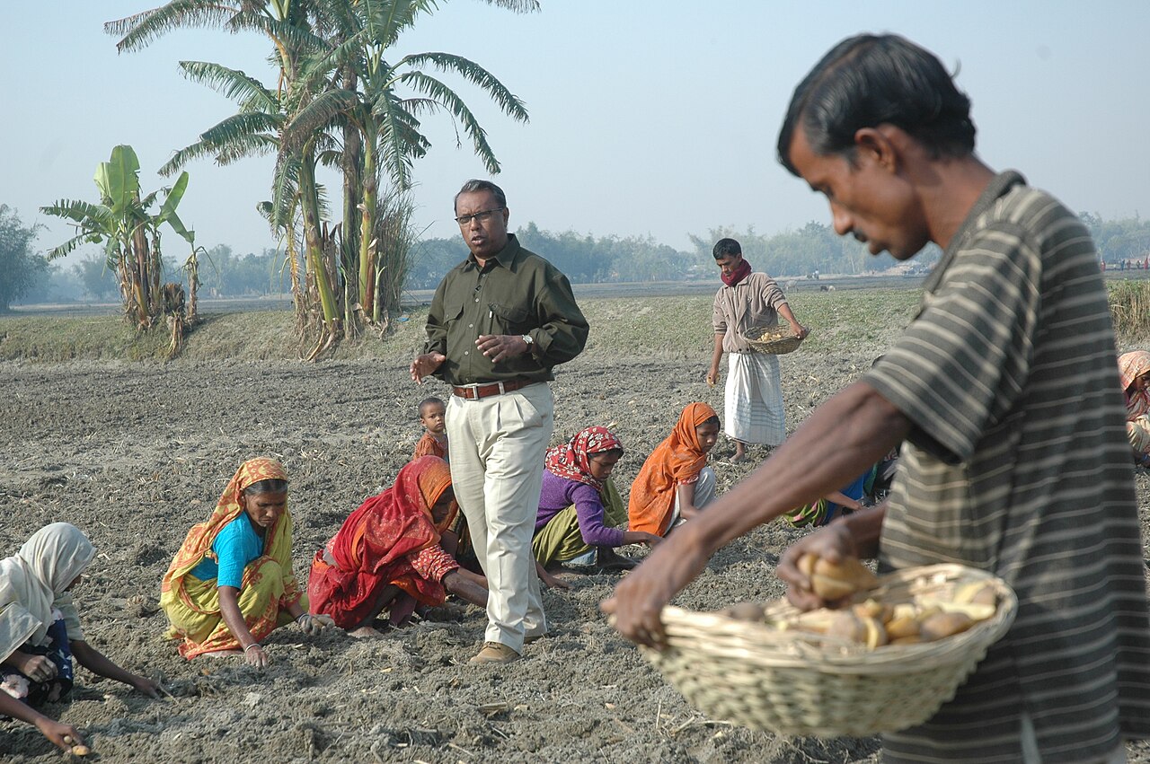
Rice is the backbone. Transplanted Aman, grown in the monsoon, and irrigated Boro, grown from winter into spring, occupy much of the land, and a common sequence leaves a field under Boro, fallow for a few weeks, then under Aman. On the better-drained ridges, the cool winter opens the way to potato, maize, wheat, mustard, pulses and vegetables.
A field survey in Mithapukur upazila of Rangpur, published by Zaman and Islam in the journal Tropical Agroecosystems in 2020, gives a snapshot of how farmers actually combine these crops. The most common pattern was potato followed by two rice crops, on 18.26 per cent of the land studied. Rice, fallow, rice came next at 15.65 per cent, and maize, fallow, rice third at 13.91 per cent.
Four and five harvests a year
Researchers have been asking whether the same land could produce more. A study by Md Armanul Islam Sarker and colleagues, published in the International Journal of Agronomy in January 2026, tested twelve cropping patterns at BARI's Regional Agricultural Research Station in Rangpur between 2021 and 2023, as alternatives to the traditional Boro, fallow, T. Aman rotation.
Four patterns stood out. Radish followed by potato with maize sown into it as a relay crop, then T. Aman, gave the highest rice equivalent yield, 42.55 tonnes per hectare, and the highest net return. Rice equivalent yield converts the value of every crop in a year into the amount of rice it would buy, so different patterns can be compared. A mustard, red amaranth, mungbean, T. Aus, T. Aman sequence made the fullest use of the land; garden pea, red amaranth, mungbean, T. Aus, T. Aman gave the best benefit-cost ratio; and potato, red amaranth, mungbean, T. Aus, T. Aman created the most work for farm labourers. The authors report that the intensified systems maintained or improved soil fertility.
A second paper, by Md Mostahed Hossain and colleagues in PLOS ONE in March 2026, reached a similar finding from a different direction. Using two early-bulking potato varieties, 7 Alu and Sagitta, which were lifted 55 days after planting instead of the 80 to 90 days of the familiar Cardinal, the researchers at Burirhat fitted four or five crops into a year instead of three. Potato equivalent yield rose by 43.84 to 111.46 per cent over the usual potato, Boro, T. Aman pattern, and the best sequence, 7 Alu, garden pea, red amaranth, T. Aus, T. Aman, returned a gross margin of Tk 538,775 per hectare.
Farmers and agricultural livelihoods
Behind those tables are some of the poorest farming districts in Bangladesh. Greater Rangpur was long associated with monga, the seasonal hunger of the weeks between Aman planting and harvest, when farm work dried up and food ran short. Earlier-maturing Aman varieties, such as Binadhan-7, the rice used in the Burirhat trials, helped shorten that gap and freed land sooner for winter potatoes and mustard.
For a smallholder, an extra short crop is not an abstraction. A few weeks of red amaranth or mungbean between two rice crops can mean cash in hand, vegetables at home, nitrogen returned to the soil by a legume, and paid work for neighbours, which the Rangpur study counted as one of the benefits of intensified patterns.
The same diversity that creates opportunity also raises the stakes of each decision. A farmer whose plot sits in a basin cannot just copy a neighbour on the ridge. Planting dates, varieties, irrigation and fertiliser all need to fit that particular piece of land.
Opportunities for agriculture
The research points to several openings. Short-duration varieties of rice and potato can create room in the calendar for a fourth or fifth crop. Legumes such as mungbean and garden pea can add protein, income and soil nitrogen. Relay cropping, sowing one crop into another before the first is harvested, saves days that matter in a tight calendar. And cheaper canal water, where it reaches, lowers the cost of irrigated crops.
Better soil management is an opportunity in its own right. Because BARC rates zinc and boron as very low to low across the zone, researchers have tested how much of these micronutrients crops actually need. A study published in the Journal of the Bangladesh Agricultural University in 2017, run at a Bangladesh Institute of Nuclear Agriculture substation and on farmers' fields in Rangpur, found that a wheat, mungbean, T. Aman sequence responded clearly to added zinc and boron.
Challenges facing AEZ-3 agriculture
The first challenge is in the soil itself: strong acidity in places, low organic matter and a long list of nutrients in short supply. Intensive cropping draws more from the soil each year, so more harvests demand more careful feeding.
Blanket fertiliser advice can also go wrong. In the Mithapukur survey, only 35 per cent of farmers applied zinc and 23 per cent boron, yet soil levels of zinc, boron and manganese had risen under the dominant patterns while copper and iron had fallen. The authors found the micronutrients they measured above their critical limits and warned of a building toxicity risk for all of them except zinc. Too little and too much can occur within the same upazila; only testing tells them apart.
Water is the second pressure. Year-to-year rainfall varies several-fold, dry-season river flows are uncertain, and pumping costs weigh on every irrigated crop. Monsoon floods, though usually shallow across most of the zone, can still damage Aman rice in the lower ground.
The third is the gap between a trial plot and a farm. The PLOS ONE authors themselves note that their results came from a single season at one station and call for multi-year, multi-location validation before the patterns are recommended widely. A pattern that pays at a research station must still fit a farmer's labour, credit, market access and appetite for risk.
From zone to village, from village to field
If the zone is too broad a unit for advice, the obvious next step is to go smaller. One practical proposal is a village agricultural data profile: a long-term record for each village and, within it, for each field. Such a profile could hold:
- field location, boundaries and height above the surrounding land
- soil texture, pH, organic matter, nitrogen, phosphorus, potassium and micronutrients
- soil moisture, rainfall, temperature and the history, depth and duration of floods
- distance from the nearest river or canal and the source of irrigation
- crop, variety, planting and harvest dates, fertiliser use, pests and diseases
- production cost, market price and yield
Satellites can add a seasonal view. Indices such as NDVI and EVI, which measure how green and vigorous vegetation looks from space, can show when a crop emerged, how well it grew and when it was harvested, field by field, year after year.
Where artificial intelligence fits
Records like these quickly grow beyond what anyone can read by hand. Artificial intelligence and machine-learning models can search years of data for patterns: which crops perform most consistently on a given field, when yields tend to fall, how rainfall and temperature affect production, where irrigation demand is highest, which nutrients need attention and how floods change the outcome.
But a computer's prediction is not a field-tested recommendation. The research cited here repeatedly stresses validation, and the same discipline should apply to any model. The right sequence is data, analysis, field testing, farmer feedback, improvement and only then adoption.
What a farmer needs at the end of that chain is not a research paper but a usable sentence: this field holds more water than the higher land next door, so irrigate on a different schedule; or, on past soil and weather records, this crop carries less risk if sown in this window; or, a short crop can fit between your two rice harvests.
Why AEZ-3 matters to Bangladesh
With close to a million hectares across ten districts, the Tista Meander Floodplain is one of the country's largest farming zones and a mainstay of its rice, potato and maize harvests. What happens to soil health, water costs and crop choices here matters well beyond Rangpur.
It also carries a wider lesson. Rivers, sediment, land height, soil, water, weather and farmers' own experience interact to make a farming system that no administrative map can capture. The useful question for research is not only what new technology exists, but where, when and for whom it actually works. The path can be summed up as zone, village, field, data, research, field validation, farmer adoption and measurable impact.
The Tista shaped this plain over thousands of years. Whether its farms grow more resilient and more profitable in the years ahead will depend less on the river than on how well scientific knowledge, field-level data and the experience of the people working the ridges and basins are brought together.
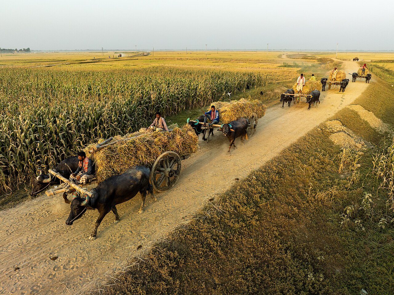
Cover photo: farmers in Rangpur carry harvested rice past a maize field. Photo: Sultan Ahmed Niloy / Wikimedia Commons (CC BY-SA 4.0)

Comments
(0)